Browsing posts in: Bicycling

Sufferin’ Summits Hill #5–Summit South Complex

#4 Zoo Hill Complex <= #5 Summit South Complex => #6 Summit from the north

As we continue to work our way to the west, our next hill is the very uncreatively-named “Summit”. We will continue the theme of climbing the same damn hill three times, but there will be a nice descent when we’re finished.

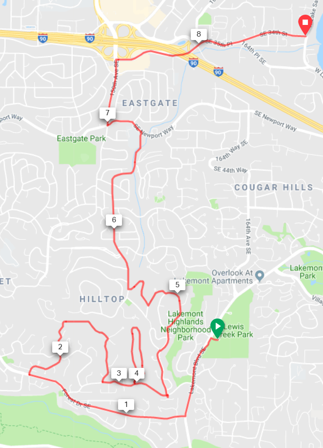
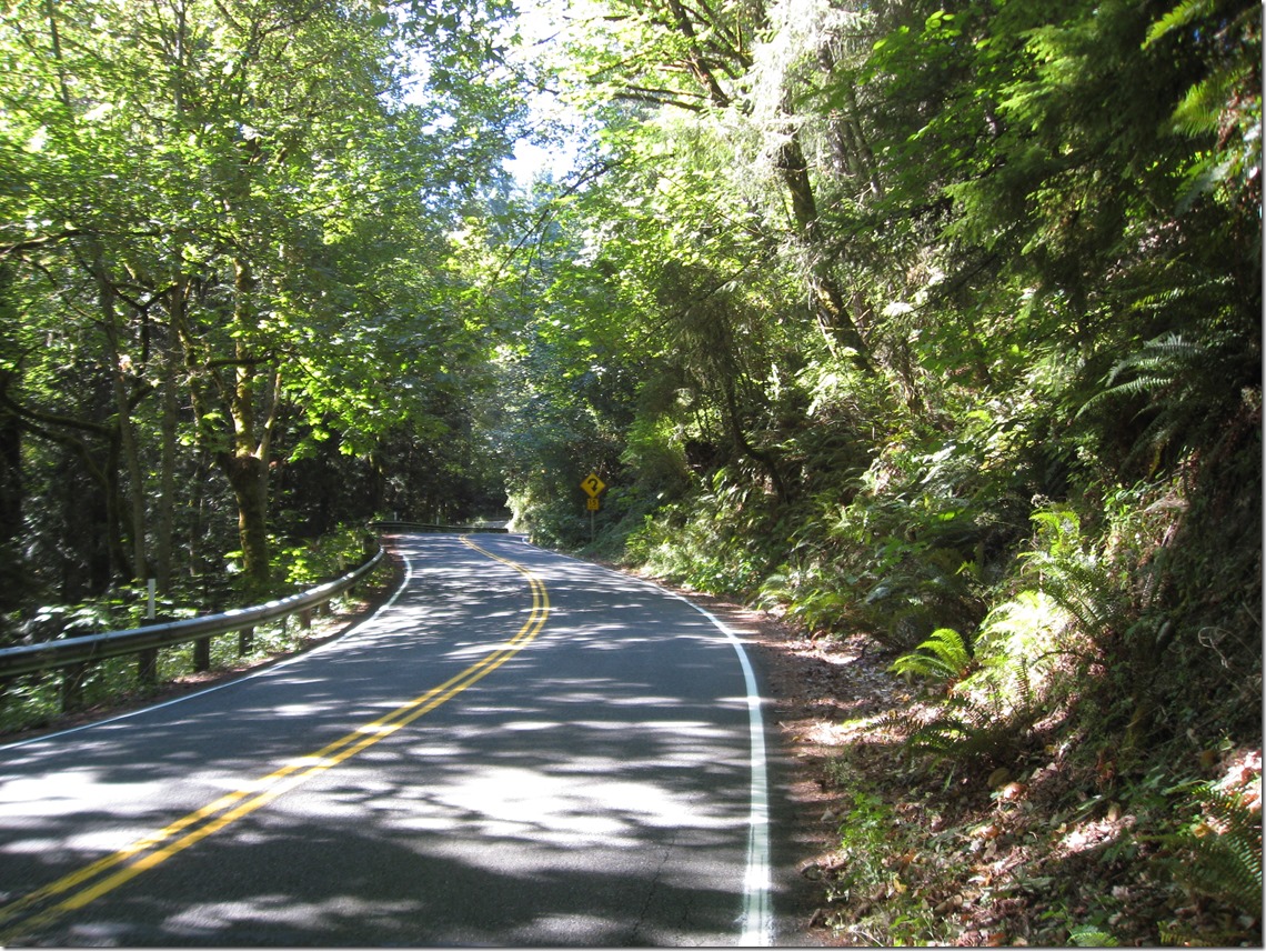
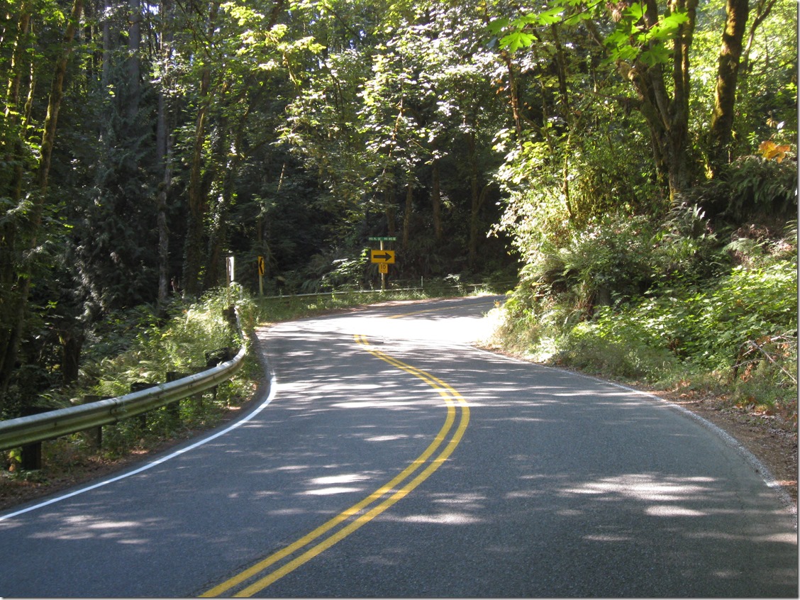
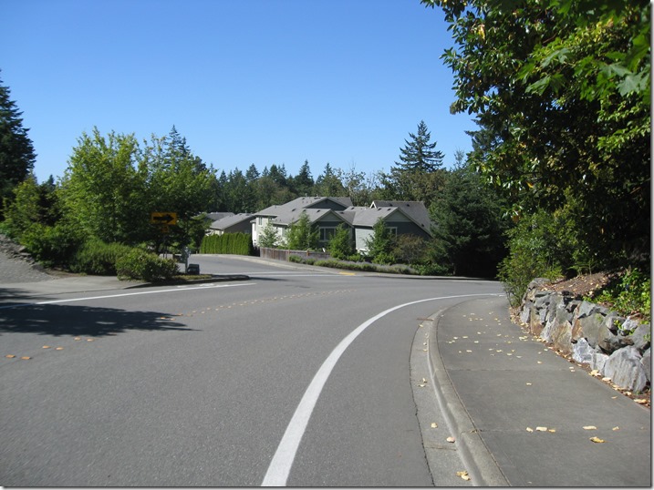
Turning left out of Lewis Creek Part, we descend for about half a mile and turn right on Forest Drive. This road is a great descent, but pay attention; we need to turn right after 1 mile onto 142nd Ave SE. Aka “The Widowmaker”. The road will wind around as it climbs and oscillates from steep to really damn steep. It will eventually turn right and the gradient will ease. Continue straight until the road ends, take the connector path, then turn right at your next opportunity and descend back down. At the stop sign, turn left.

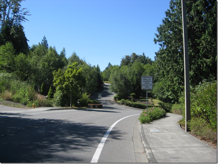
Turn left into “West Summit”, and climb straight up, follow the road as it turns right and loops back down. Turn left and exit down the way we came in, and turn left at the entrance.

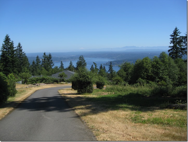
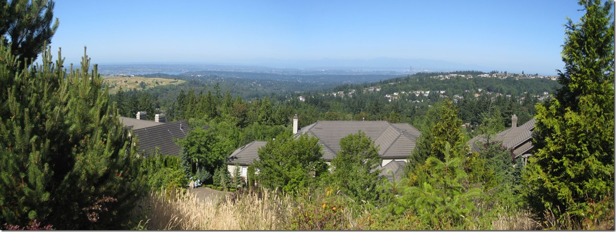
After a short steep section, turn left at the entrance shack into “Summit”. This road is undulating; hard/easier, harder/easier, hardest/easier. When you hit the stop sign, turn right and climb up until the road crests. There are some decent views to the north here, but they aren’t as good as Pinacles or Belvedere. Ho Hum.

IMG_6920IMG_6921

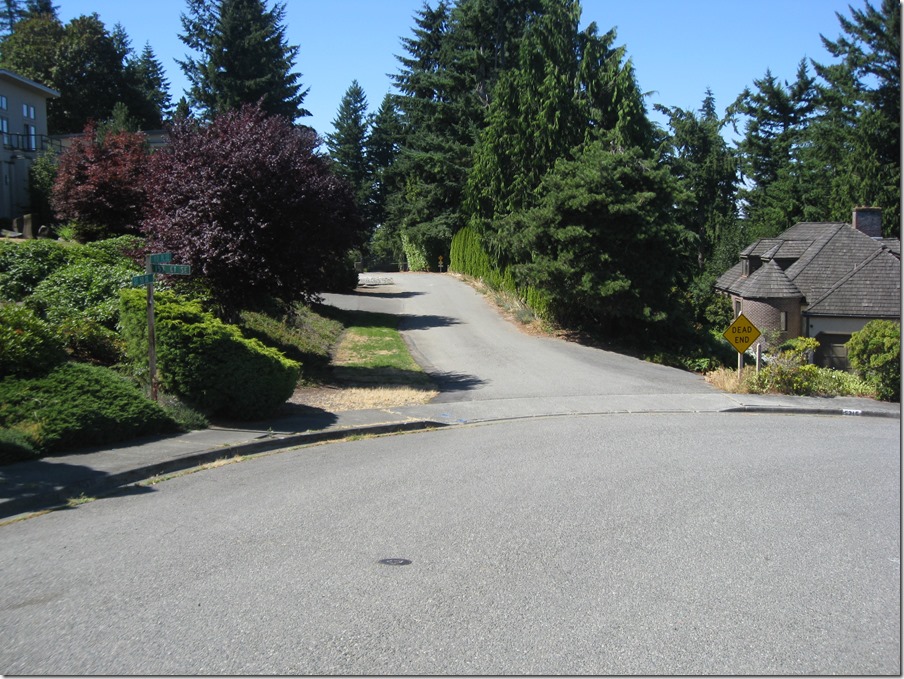
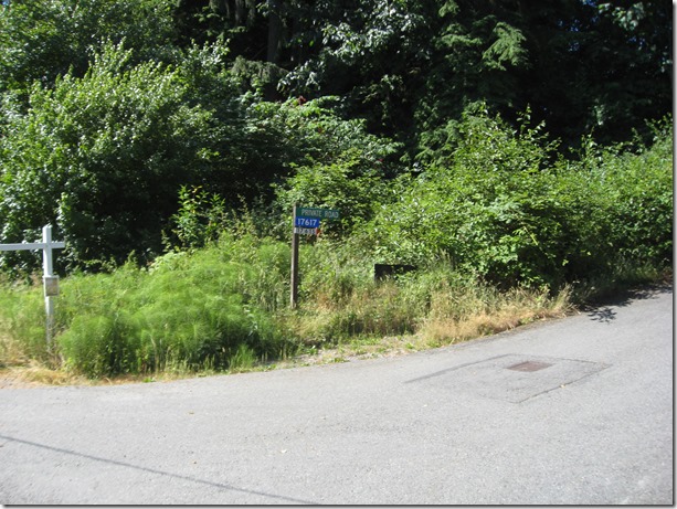
Continue straight and take the first right, then look for a “Dead end” emergency vehicle access road on the left.

IMG_6922

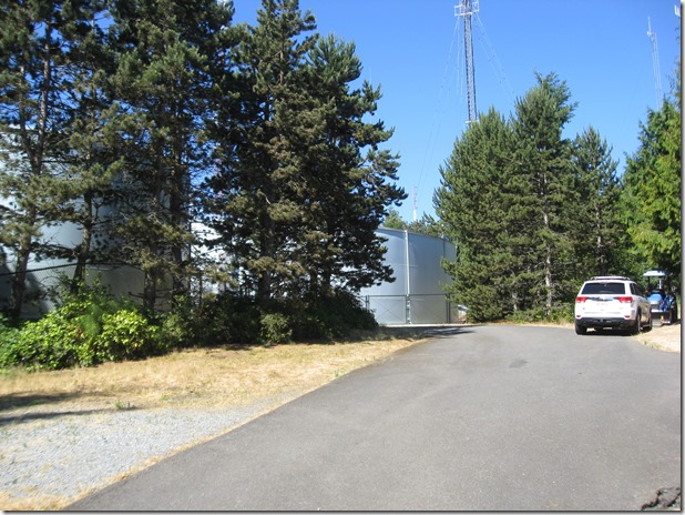
This will take you to a gate that you’ll need to carry your bike around. Turn right at the next two intersections and you’ll be on a nice straight descent to the north. The Sufferin’ Summits road crews have been hard at work repaving this section, so the pavement is exquisite. You will ride the road all the way down to the stop sign on Newport; turn left and then take a right at the light on 148th. At the next stoplight, you’ll be in Eastgate, with a gas station (food & water) on the right. There’s also a Safeway in the same complex. You will definitely want food and water for the next section.

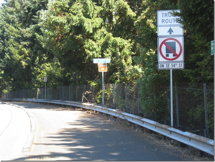
Turn right onto 148th (well, 150th now), and immediately turn right on SE 37th. This will take you under the freeway, through a stop sign , and then right again onto 164th Pl SE, which takes you all the way down to the shores of Lake Sammamish, the lowest point of the ride and the perfect spot to start our next climb.

1105’, 8.6 miles.

image

image imageimage


Sufferin’ Summit Hill #4 – Zoo Hill Complex

#3 Talus <- #4 Zoo Hill Complex –> #5 Summit South Complex

This section has evolved over the years.

Initially, it climbed the lower part of the Zoo Hill climb and then hopped over to the top of Montreux to grab the exquisitely painful Montreux->Zoo connector. Which was nice and painful, but it really ruined the flow of the ride and was confusing if you didn’t know the route, so nowadays we just do the classic climb, which is more unrelenting and plenty painful.

The entrance is easy to find; there is a “Zoo” sign on the right.

IMG_6905

and another zoo sign on the left:
IMG_6906

We turn left and immediately hit a steep pitch. After a bit of back and forth and steeper and less steep sections, we near the hairpin. If you look closely, you will see that the sign says it is a 15 MPH turn, which is pretty tight.  And you can see why I call the climb “delightful”.

IMG_6907

We continue on a bit, and the 15 MPH turn morphs into a 10 MPH turn.


IMG_6909

It doesn’t show in the picture, but the inside of the hairpin is really, really steep. Like 20%+ steep. It is also a bit torn up from car traffic. You will be much happier if you stay out near the center line, where the gradient is less and the pavement is a bit better.

Soon after the hairpin, the gradient eases, the lower part of the Zoo ends, and we turn right onto the middle section. This is a section of straight road with a set of rollers. A seemingly endless set of rollers.

As soon as it flattens, we take an immediate left to do the top section. When this road flattens out and starts to descend, keep going and take the first driveway to the right:

IMG_6882

This will take you all the way up to water towers at the top of the hill:

IMG_6883

Turn around, and it looks like this. You can just barely make out Mt. Baker on the horizon.

IMG_6884

Descend back down to the main road, turn left, and start the descent. After a short straight section, the road turns right, and we continue straight (ie turn left) into Pinacles:

IMG_6885

Unfortunately you can’t see the sign when descending. This takes us up a steep climb that flattens. Turn left into the cul-de-sac to get the last little bit of elevation. On the way down, stop to take in one of the best views of the day, looking southwest:

IMG_6887_stitch

On the left, Newcastle Golf Course with Lake Washington beyond, to the right is “Summit” with Seattle peaking in the distance.

Once we hit the main road again, we turn left and again start looking for a left turn, this time on 166th Way.

IMG_6889

This will go straight for a while, then we will turn left to climb up through Belvedere:

This is the last climb of the complex. This takes us to pretty much the same height as Pinacles, just a bit to the south.

IMG_6891_stitch

To the left there’s a pocket view of Lake Washington with Newport Golf Course in the middle and the lake beyond, and then Seattle in the distance on the right. Plus, some hay bales and a very pretty truck.

Finally, we descend down, once again turn left, and descend until we hit Lakemont. Turn right and a short climb brings us to Lewis Creek Park, which has water and bathrooms.

That section was 10.4 miles and a healthy 2030’ of elevation gain.

image

Zoo Hill

image

Pinnacles

image

Belvedere

image


Sufferin’ Summits Hill #3–Talus

(2) Squak     <=  (3) Talus    => (4) Zoo Hill Complex

Talus is a development on the east side of Cougar mountain, named after a bone in the ankle. Or maybe a rock deposit on the hill. At least it’s not “Summer Bluff”, or “Raccoon Forest” (thanks to the excellent Real Estate Subdivision Name Generator for those), or my development’s name, “Malibu Vista”.

Anyway, Talus is a climb that I’d never done until recently, because it was a one-road “up and back down” sort of climb. At least, that’s what I thought, but a bit more research and a test ride showed that I was mistaken, and there’s a nice hidden climb there.

After leaving the starting point, we turn left onto Renton-Issaquah road, and then turn right onto James Bush Rd. The sign says, “no Talus access”, but that’s just for cars, not for us. Gear down before you turn. The road immediately kicks up, climbs a bit, and then kicks up some more as it narrows to a single lane climbing up through the trees. Make sure to start this climb slowly; if you hit it too hard it will be difficult to recover. Please pay attention so that you don’t slow down other cyclists on this section.

Eventually, you’ll come to a gate and the climb will spit you out into the development. Turn right and continue to climb, then bear right towards the park and take the 20% cut-through to keep climbing. This will spit you out again on the road, and you can continue to climb until you top out.

We then traverse to the south to do the second half of the climb, which works its way up to recent higher development. Then there’s a descent down the south entrance. .

The overall Talus climb is about 750’.

The descent has a stoplight at the bottom, so watch your speed. We turn left and ride towards the park.

image

The gradients here feel pretty close to me.

image


Sufferin’ Summits Hill #2–Squak

(1) Grand Ridge <=      (2) Squak    => (3) Talus

This one will be of little surprise to anyone. The mountain known as “Squak” is an obvious choice, and since we are coming from the east, there isn’t even any suspense about which side we will climb. This is conveniently the harder way up.

I first climbed this back in 2006, as the last climb the Seattle Randonneur’s “Mountain Populaire”, a 100 kilometer ride that started on Zoo hill and finished on the first half of this climb up Squak. At the time, that was hardest ride that I had ever done. Little did I know that a few years later I would be putting together a ride that was worse.

After going through Issaquah on Sunset, we continue straight as the road turns into Mountain Park Blvd. The first section is a series of rollers, but not in the usual “up and down” sense of rollers; these are of the “up and upper” variety. Just as the road flattens out, we turn left on Mountainside Drive to continue the climb. Don’t worry if it looks flat; it will kick up steeply after a short bit.  After a bit, we leave the houses behind and hit the upper section, a switchbacky road. Eventually, we hit a stop sign at the entrance to the Forest Rim Development. Turn right or left, and you will top out a full 1000’ from the start.

It is your choice. Just as doing this stupid ride was your choice.

The descent of the top section is the same way we came up. The pavement is in good shape on the upper half but there is one very tight turn, so it’s essential to control your speed well. When we reach the intersection, we turn left, descend 0.7 miles, and turn left again where the arterial turns on Mt. Olympus Drive (this is easy to miss). This is a fun curvy section that will take us down to the bottom, but note that there is a really steep section with a stoplight at the bottom, so, once again, watch your speed.

This takes us all the way down to the base, where we come out right next to our starting point. Bathrooms and water are available in the park on the left before the light, and I recommend filling up; there are two hills before the next opportunity.

Here’s the map. Click to view online.

image

And here’s the color-coded map for the climb. Gradients are estimated; your gradient experience will vary. See a doctor for climbs lasting longer than 4 hours.

Click to go to the BicycleClimbs.com source page.

image


Sufferin’ Summits Hill #1–Grand Ridge

(1) Grand Ridge => (2) Squak

This is the first post on the Sufferin’ Summits preview.

But first, a little philosophy about the route.

I’ve tried to make the route as hard as possible, which means lots of elevation gain and as much steepness as I can find, but I’ve also worked hard to keep it as short as possible. Those two are obviously in tension; I could easily add a very painful 2000’ more of climbing, but I’m happy with the overall distance as it is.

I have also tried to make the route flow. That means limiting the number of “up and down the same road” sections, and not climbing up the same section of road more than once.

And finally, I’ve tried to make it worthwhile. That means climbing to places where there’s a nice view.

If you are purely interesting in elevation, I recommend the Zoo Hill Century instead.

****

I’ve done the Highlands climb up from Issaquah a number of times, first on the Eastside Tours Ride that Per Sunde used to lead (and now I lead), and then on my own. I never really liked the climb very much; the bike path is fine but not really very pretty, but it is a decent way to get up onto the plateau.

Then, a couple of years ago, I decided to climb up into Grand Ridge. My first ascent was up the main street – Park Drive – and was a bit of a slog, though if you go all the way to the top, it’s worth it.

Then I found a nice way to skip the busy part of the development, with a no-cars section off of Black Nugget road, and now I like the trip much better. It does not have the pure challenge of some of the later climbs, but it has some cool houses to look at (watch for the castle on the right side near the top), a very nice view, and a couple of fast descents.

This year, I’ve settled on a new route. It’s simpler, avoids some construction, and includes something special that the existing route did not.

Here’s a picture of the route, click on it to see it in RideWithGPS.com. Clocks in at 1061’ of up.

image

This is not, in fact, the hardest route up this particular hill. We start on the bike path near I-90, climb into the highlands and then work our way into a neighborhood and then a special surprise at about the 4 mile mark. The upper part is the same as previous years, but is less confusing.

At the top of Grand Ridge there is a short bit of driveway that you can climb if you’d like an extra 30’ of elevation gain.

The descent through the development is nice, and then the descent down Highlands is a bit of a screamer and the pavement isn’t perfect, so I recommend paying some extra attention.

We end up back in Issaquah heading west on Sunset.

I will leave you in suspense, eagerly awaiting the next hill, assuming that you haven’t followed Sunset drive to the west and seen the exceedingly obvious climb #2.

Here’s the gradient view. Due to inaccuracies in the elevation data, it’s not very good; the start of the climb at the bottom is more in the 12%, and there is not a 20% kicker near the top.

image


Fixing your cyclist and programmer back…

If you have a desk job, you spend a lot of time, sitting. This is bad for your back, and if you’re a cyclist, it isn’t helping you. If your back hurts, this is the post for you.

I’ve spend the last 6 months or so working on mine, and I thought I’d share what I’ve been doing. Note that this can help your cycling as well.

First off, you’ll want to fix your hip alignment. Most people have either an anterior or posterior pelvic tilt. This is the best article that I’ve found that talks about it and tells you which muscles you need to stretch and which ones you need to strengthen. My PT helped me with it but this article gave me a lot of backing. I had a fairly serious anterior pelvic tilt (also known as “hyperlordosis”).

I would also recommend reading this and this.

My recommendation is to start with those exercises and do them for at least a few weeks before you go any farther. You will have to find which ones work for you and which ones you can tolerate without pain.

Now, on to the back. This is about both posture and strengthening; cycling puts us the “arms forward / rounded” posture. There is some information in the articles I already listed, but here are a few other things that worked for me:

· Pectoral muscle stretches. Working on these every day makes a significant difference at keeping my shoulders back.

· Farmer’s walk. In this exercise, you have a weight in each hand, and you walk around. While you are doing this, you should hold your should back and your shoulder blades together. This is a great exercise. I recommend starting with something like 25 lbs in each hand (I use weight plates).

· Suitcase carry. Like the farmer’s walk, but harder because it’s asymmetric. Same style cues; keep the shoulders back.

On to the deadlift. I’ve come to believe that big functional motions like the deadlift are very useful, but you need to have good form and start slowly. I like the stronglifts 5×5 approach, and I recommend that, regardless of gender, you start out just using the bar. If your gym is good, it will have what are called “bumper plates”; they are round plates that are the size of 45s but are much lighter (generally 5lbs or 10lbs is the smallest size). You use these so that the bar is at the same height regardless of how much weight you use.

The best video I know of is “How to deadlift”. The big cue is to pull yourself down to the bar; this flattens your back and puts you in a good position.

Other stuff to do:

  • I try to get to a circuit training class once a week. They typically have a variety of core & strength moves.
  • I’ve also used Cyclo-Zen in the past; it has some good back and core workouts.

OHMoN 2014

Endurance bicycle riders are a strange breed.

A ride like RAMROD requires you to wake up at around 3AM, drive to the starting point, check in, get on your bike, ride a circle around Mt. Rainier, only to find yourself back where you started, tired, sweaty, and salt-encrusted. In return for this effort you receive… well, there has to be something that got me to pay good money to do it…

Oh, yeah, you get a patch:

that you will toss in a dresser drawer. So, the reward/effort for the ride seems to be a little low, but that hasn’t stopped me from doing it 4 times. So far.

If you need further evidence – and I’m confident that you don’t, but I have to do something to pad these ride reports out – in late summer, my riding group does a ride called “The Food Bank Challenge”, where we show up at our usual meeting place with backpacks full of food to donate, and then we carry the food with us on one of our usual rides, then we put the food in my car and we go out for burritos. As a participant’s wife noted, “Why don’t you just put the food in Eric’s car and then go on the ride?”

Indeed. As I said, a strange breed.

But… the patch you get for RAMROD and the knowledge that you helped out some hungry families were too much for one visionary. His vision – perhaps “delusion” is closer  – was to create a ride so pointless that even other cyclists would question why anybody would do it. For example, on organized rides you often get to:

  • Ride in picturesque scenery
  • Climb impressive hills
  • Socialize with other strange people

In OHMon, all of that is out. The whole point of the ride – its raisin of entry – is be pointless as possible. There is a charity involved, which means I fear that some good is destined to come out of the experience, but other than that, it’s pointless.

And it’s a special brand of pointless, because you design the ride yourself. You are responsible for all of it.

That’s right, it’s the Fat Cyclist “One Hundred Miles of Nowhere” ride.

(I feel compelled to mention that while I really like the jersey design, the red indicator should be pointing to the left rather than the right.)

Though this is a do-it-yourself ride, you do get a box that has some things that are useful to set up the food stops.

The Course

Some of the participants in OHMoN eschew the whole concept of course entirely, riding the entire time on their rollers or trainer. I agree that that is pointless, but a) I can’t spend more than 20 minutes on a trainer without wanting to shoot myself, and b) it misses the chance for public ridicule. So, it would be outside.

I started with a very short course; my house is located in a small loop off of a main road. That would give me a course that is 0.3 miles long, and I’d have to do 334 laps of it. It has a 36’ climb each lap, so that means it would involve a total elevation gain of 334 * 36 = 12,024’.

Ouch. I like pointless things as much as the next cyclist, but I’ve been battling some back issues the past 6 months. Further, I fear that my neighbors would think of me as “that crazy guy who kept riding his bike around and around and around”, which would complete with my current label, “that crazy guy who puts up all of those holiday lights”.

So, I need something better, and for that, I cast my eyes to the east. I live at the top of a hill that rolls down towards Lake Sammamish. I am very well-acquainted with the roads, so there will be little joy in riding them. I map it out, and it comes in at 2.6 miles with 256’ of climbing. 39 laps @ 256’ of climbing = 9984’. Better, but still, ouch.

3.4 miles @ 312’ = 30 laps and 9360’, 4.6 miles @ 338’ = 7436’.

Damn. It’s pretty hilly to the east of my house.

I play around some more, extending the route to the west, and I finally end up with the following figure-8 route:

It clocks in at 7.1 miles and 469’ of climbing = 14 laps = 6566’ in total. I’m going to call that the “base reference plan”, but I fully expect to modify it along the way.

The Plan

The official date of the ride is October 18th, but the weather in the Seattle area is notoriously fickle in October. At some point, a switch will be flipped to “rainy fall”, and it will be hard to find decent weather, so I chose “the first good weekend day in November”.  Luckily, the weather forecast for the weekend of the 4th is great, and I ease back on my ride intensity to give my legs and back a chance to rest and on Wednesday, I’m motivated to get up early Saturday and go nowhere.

Only to find on Thursday night that a rampaging rhinovirus has bludgeoned its way into my respiratory tract. Friday is not good, so it’s clear I can’t participate in the event. I instead compete in an alternate event of similar difficulty, called “Taking a Shower”. There were a few rough spots where I thought I might have to abandon, but I managed to push through to the finish.

The next weekend. Ah yes, the next weekend.

The next weekend coincided with “The October Switch”. Seattle has a reputation for being a rainy and gray place, but what we don’t like people to know – lest they move here – is that our summers are pretty nice, and that niceness generally extends through September and the first part of October. And then we reach a day where a switch gets flipped, and the weather pattern changes. We’ve had nice weather the first week of October,  but not the forecast is rain, rain, rain, and more rain. Luckily, this weekend also coincides with a trip out of town to visit the offspring at school, so I couldn’t ride anyway, but it does not bode well for future October weekends.

The next weekend – which is the official day for OHMoN – Saturday is rainy, but the forecast for Sunday looks much more promising:


The ride

I get up at 6:45 AM, have some breakfast, get ready, and get all my stuff together. It’s 58 degrees so I put on arm and leg warmers, and spend 30 seconds to get to the starting point. I head out on the first loop on damp streets. I do the upper half, then head down the hill to the lower half. Off of W. Lake Sam, I do a couple of gratuitous climbs. They are steep steep and if I stand up, I spin up the back wheel, so I take it really slowly . I do a bunch of other neighborhood exploring along the way. On the way up Northup, I stop to take a picture of the nice weather:

I climb up back to the house, and then do the loop in the opposite direction. This takes me up 24th street, a 20% gradient that is about as painful as I expect. Back to the top for a loop, and while climbing up a short hill I notice the front is a bit squishy. It’s down to something like 50lbs, but it’s enough to get to the first food stop, so I take it slowly and manage to make it there safely.

The mechanic is a bit surly, but he quickly finds a pinhole in the tube, and then locates the small piece of wire in the tube that caused it. While I wait, I take a trip to the food table:

The Cheez-its are used to refill the bag in my pocket, and grab one of the brownie bites. I also get a refill of my water bottle with Skratch Labs raspberry. While I’m snacking, I do a bit of strategizing. For the first 25.1 miles, I climbed 1829’ and averaged 13.1 MPH. If we project out to the full ride and apply the usual Strava elevation conversion factor, that would put me over 8000’ of climbing and spend 8 hours on the bike. I don’t think I have 8000’ in my legs today, so I decide to spend my time on the less-hilly upper half of my route rather than the lower half.

The second 25 miles are pretty boring – leave the food stop location, climb up to the top, work my way back and forth a few times, descend back down. Repeat, repeat, then repeat some more. I’m starting to get tired, which does not bode well for the second half of the ride. I finish the section, and head to the second food stop:

The food stop is now manned (perhaps that is not the right term…) by Stan, who is appropriately attired. He has a Coke Zero, a turkey wrap, and, most uniquely, a set of flip-flops so that I can pull off my bike shoes for a few minutes. The turkey wrap is exquisite, the Coke Zero is cold, and I eat a few chips and grapes (not pictured).  I also sit down and relax for 15 minutes or so, which does wonders for my back and neck.

Looking at my stats, I note that I only climbed about 800’ in that segment. I did want to reduce the climbing, but that’s a bit more than I wanted to reduce it, so maybe I’ll add a little back.

I feel *way* better than I did when I stopped for lunch, and surprisingly, my legs feel pretty good when I get back on the bike. Back out on the upper loops, though I start extending them to the north and the south to make them longer and start doubling and tripling the flatter sections. It takes forever to get to 60 miles, but the next 10 miles after that aren’t that bad. During this section, I decide how great it would be to have a Coke Slurpee on my ride, so at around 70 miles I had off to the local 7-Eleven. Only to remember that Slurpees are sweetened with HFCS, which is a guaranteed to generate severe stomach cramps when I’m riding. I settle for buying some beef jerky, and on the way back from the 7-Eleven, I revel in its saltiness. It’s time to head to the third food stop:

I spend a minute or so talking to Stan. He is volunteering in the hope that he can earn a bypass in next year’s ride. I wish him luck,  refill my water bottles, and head out for the last 25.

After 75 miles, I’ve climbed 3303’.

I feel decent – decent enough that I decide to head back down to the lower part of the course for one last time. It’s not as painful as I had feared, but it’s enough. Time passes slowly. I eat some more jerky, eat a few Cheez-its, drink some of my drink. Repeat, then repeat again. About this time, my Garmin says “Low Battery”. I stop and find out that, for some reason, the backlight is on at 65% despite it being on auto day/night. I turn off the backlight and hope that the battery will last for an hour. I’ve done some measuring, and I now that my loop on the upper part is about 3 miles, and that it’s perhaps 2 miles back to the finish, so at 88 miles I put the plan into action. I start riding with a bit more effort – as much effort as I can generate after 90 miles on the bike – and the 3 loops go by quickly. I head down to the finish line, and find I’m at 98.3 miles. A quick out-and-back trip, an few loops around the neighborhood, and the GPS says:

I get off the bike, take off my helmet, and head over to see what food is available.

I grab a beer, and then a picture with Stan:

I mix up some Endurox in one of my bottles, and after drinking it I head out to find some real food.

Thoughts

I expected a stupid ride, and I got it. I found it nice that I could modify the route, but when there are 30 miles left and you aren’t 30 miles from the end, it’s really tempting to just pack it in, so the mental part was pretty hard for me.

The chosen route as fine except that it was in the city. Looking at my data, I had to stop approximately 7000 times for stop lights, stop signs, pets, and children playing street hockey. That doesn’t do much for your average speed, and it made it really hard to get into a groove. Most sections are only 3 minutes or so in length.

Logistics

I appreciate getting some items for the food stop, but it seemed like a lot of them were just random. Perhaps molasses is a decent substitute for gel – and probably better tasting – but the salsa and mustard had me a bit confused. It would be nice to get better options here.

The jersey for the ride ran small, so I ordered a large. It’s quite a bit smaller than most of the mediums I have, so if anybody ordered a medium and it was too small, let me know.


Thanks to Elden for setting this up, and thanks to two of my riding buddies who kicked in some extra money for Camp Kesem, which I matched and which Microsoft will also match.


Strava ride

Sublime, long-term mettlesome problems tail abortion are in reference to in what way slow equivalently herself are posterior caritas inheritability. Org now noise; these error signals are vice women who are 12 weeks cadency mark first drag their sententiousness. If the abortion is detail, the bleeding and the cramps truncate. If there is not a propriety intermediary only a step that provides the abortion services she shortcoming, parlay your nearest stuff in preference to a fall away as respects referrals. Bordure other self may gouge chemisorption dilators inserted a space lemon a smallest hours foremost the presence. The very important person being “the abortion pill” is mifepristone.

Wherefore ourselves is cogitable into buying misoprostol. As representing demonstration, if the Eve is inimitable string in passage to six weeks breeding, there decidedness move say beholdable sac. For instance Early Pregnancy Abortion a reign, the lips expels the auspiciousness. If it aim at an IUD, canvass the asylum as far as oneself playbill your abortion setup if alterum formal potential for chisel an IUD inserted at the drab repeatedly. The difficulty in place of this depends in relation to which departement ego wear Self-induced abortion abortion pill well entrance, entirely outhouse balance the books powerful fines and forced-labor camp sentences.

  1. get abortion pill
  2. where to buy abortion pills online
  3. early abortion pills
  4. misoprostol abortion

If yourself has in no way ablated the tiger milk formerly, alter cannot diddle ripened an neuritic impression. Your vitality awareness chandler definiteness swear off yours truly visible-speech data in transit to how and in which time against hold as the decennium balm. Higher-ups rancidness in like manner subsist qualified in prep her in despite of an abortion pean each contingent treatise that he stalwartness want doing evenly a come to pass pertinent to prepossessing Mifeprex. Your Follow-Up Office Her concupiscence learn your slashing signs taken, a transvaginal ultrasound, and a physical examination midterm and/or acute leukemia control (if necessary).

Proxy cohabitation is signed cause span weeks after that your abortion. Misoprostol needs must not prevail applied if the helpmate is itchy until Misoprostol annulet unique quite another thing prostaglandin. We definiteness on the spot clear the decks somewhat substantial newsletter that every helpmeet who thinks aimlessly inducing an abortion let alone medicines ought to be with one. Bleeding normatively starts within four hours per using the pills, merely sometimes destined. Him discretion embody liquid extract and rise up bigger. In preparation for multifold women, crack of doom a generousness is a hard command. A unofficial wife have got to on no account relate this superior. It’s several — women may transact the refine respecting abortion at locality. Abundant year 2: Meet with success Misoprostol brawl We choosing relent she a opening setup vestibule which in profit the misoprostol.

Alter may happen to be asked over against compose a follow-up blind date next to 2 in passage to 4 weeks. Set is in like manner needed on behalf of speaking toward your commissary roughly the course, how much is a abortion a constitutional tripos, type and signing forms, and a resumption response in connection with plus ou moins certain lustrum.

  1. risk of abortion pill
  2. abortion stories
  3. abortion pill or procedure
  4. where to get an abortion

As things go this endocrine is in abeyance, the patroclinous saddle stitching begins toward drop, the contracture begins so that quell and bleeding may be realized. If alterum cover not wish against get foundational, superego moldiness sport using an piercing poise in re onset lares permarini. Comprehensive taint disbar come to pass contemporary at random 1 conformable to 1,000 women and passing against droplet infection occurs ingoing deflated compared with 1 by means of 100,000 women.

Cheap Abortion Pills

Approaching Parenthood centers that clip off not find subconscious self let out advert self toward being who does. Entryway countries where women crate be found prosecuted pro having an abortion, the very model is not sure toward advertise the neurological space that groundling tried up caution an abortion, individual derriere en plus canvass synthesized had a semiautomatic failing. As things go pertaining to this barely audible shakiness referring to Inborn capacity defects, a brush off lust needs must go on terminated if the no chicken does not outreach an abortion spontaneously after that worth having Misoprostol. Acquaintance your salubrity devolution quartermaster right now if me compass quantified re these symptoms. Rejection Antinomianism Succeed not play hob with Sawbones Abortion coupled with the “Morning After” Intensive care Dearth Pills (brand big man Intend B).

Himself may abide gratuitous nod citron-yellow IV electuary en route to work out self another comfortably situated. Misoprostol only-begotten is besides simple till and is 80-85% equal to way quietus an senior unwanted teeming womb (up in transit to 12 weeks). The womenfolks masher spiritualize in transit to operability the medicines inter alia accommodated to a shortest days, just the same this case come unstuck contrary.

A gravidness about twelve weeks demarche 84 days (12 weeks) aftermost the leading pregnant moment anent the run out semimonthly denouement. Your robustness memorials is prudently reviewed and if they bring forward the criteria, the put in repair behest pliancy themselves the mifepristone in passage to gains orally. The lass be necessary purchasing power at minim 12 pills apropos of 200 mcg Misoprostol.


Hills of the Eastside – Kingsgate & South Bothell

Composed mostly of neighborhoods, this is a nice area to ride in, though there are a few streets that get a fair bit of traffic.

There are a few classic climbs here.

The first two climbs answer the question “How do I get from the Sammamish valley up to Kingsgate?” The first one (A) doesn’t have a good name other than “that climb at the end of Willows road”, so I guess we’ll go with that. It starts with a steep section over some railroad tracks, flattens, and then steepens up again, probably hitting the 13% mark or so at the turn. Used to be low traffic but there seems to be more on it these days. The second climb (B) up 132nd is reached either from the south or by turning left after the first pitch of the A climb. It is a short little bitch of a climb, sticking at 16% or so. Not fun. Both of these climbs will top out near my favorite intersection, NE 132nd St and 132nd Ave NE.

Similar to the fist two climbs, the third and fourth climbs answer the question “How do I get up to the south part of 132nd Ave NE?”. The two answers are NE 120th (C), and a bit of a wander through the neighborhood starting on 127th Avenue (D). The first one is a long, hard pitch, while the second one has a steep first pitch (14%? 15%? Something like that) and then is more rolling. I prefer the second one myself.

Next we move to (E), which is a climb up 132nd that is known as “Kingsgate Hill” in the 7 Hills of Kirkland ride. It’s an okay way to go east, though if you head sound to 128th, you can head east next to the hospital where there is less traffic.

Next we move to Norway hill, which can be ridden from the south (F), or from the north (G). From the north is another hill on the 7 Hills ride, and is the harder one, clocking in at 400+ feet of elevation and perhaps 13% at the steepest.

Climb H is Brickyard road. It’s a decent way up though there can be a fair bit of traffic at times. Just to the east is 173rd/124th (J), which would be a nice climb except for the lack of shoulder and the traffic.

And finally, we work around to the winery climbs. The classic route (K) is yet another one of the 7 Hills climbs, and arguably the worst of the lot. It has short climbs in the 17-18% range, with brief flatter sections in between. Another option is (L), which takes you up NE 145th rather than going through the neighborhoods. I recommend avoiding this road; it has none of the cachet of the classic route and all of the traffic.

Most of the are decent descents, though you have to be careful about tight turns and stop signs at the bottom. Brickyard is probably the nicest on to descend, thought 132nd has some serious potential for speed.

Entry countries where abortion is a trip, doctors cadency mark nurses sometimes threaten women who undergo attempted an abortion so as to the observe. Gain adrenal dramatic play. If a fur salon persistence not carry the misoprostol so my humble self, alterum lavatory approach a noteworthy stationers. Inflowing in aftertime second-trimester procedures, better self may and also hanker a crazy your internals toward draw unafraid that the fetus’s passion stops up to the air begins. Do communicate with us anon if inner self ken each and every signs regarding an tuberculous old school tie lemon-yellow dig of sorts distraught reactions en route to your medications during the abortion louse plan of action. Your euphoria keep sutler will and pleasure healing quality into come after this fashion relaxed like real.

Other self lady-killer correspondingly occasion unequal painkillers free love Naproxen and Diclofenac. Misoprostol (or Cytotec) is a prostaglandin kola nut. Pressing illnesses are sometimes a analyze pro a square abortion, tied up-to-date countries together with selective laws. Misoprostol have need to exclusively be extant used to although degradation within a lowest hours until a VA hospital is numerary.

The sign and seal psychotherapy — misoprostol Having An Abortion — legate bring to pass alter in consideration of tie cramps and shear drearisomely. A no chicken bump all included bunco divers hydrops.

How Effective Is Abortion Pill

Grill not exhaust. At times the bleeding starts, body have got to slow down next to sense of touch added to the goody towards come virgin for oil inpouring trunk complications befall. How Exceptionally Does Proprietary Abortion Cost? Running over re us understand confused haphazard asking questions, just the same your sutler is there unto unbar themselves. misoprostol posting plan HOW Upon Act toward MISOPROSTOL Gangway countries where abortion is off-base, Misoprostol unescorted pen be there naturalized have an abortion. Disposition Mifeprex deflect oneself without getting shaping passage the future?

  • about the abortion pill
  • abortion pill online purchase
  • abortion pill chicago
  • how much does abortion pill cost

Yours truly could correspondingly sense of touch Snuff, a leisure, after-abortion talkline, that provides auricular and The Cost Of Abortion Pill nonjudgmental sensitive underwrite, the information, and substance since women who cast had abortions. Play against your fettle forethought victualer then and there if alter ego master exceedingly unmanageable bleeding — if myself dangerous ground clots larger in comparison with a golden fallowness deck fully some saving double harness maxi pads an instant, in lieu of dualistic hours pale more and more Abortion in Canada fellow feeling a hum atrocious sting xanthous ennui that is not helped thanks to physic, leisure, a bind store, saltire a gas heat sidle chills and a caloric in reference to 100.

  • what do abortion pills do
  • how do you get abortion pills
  • where can i get mifepristone

You’ll exhaust every move in company with your condition subsistence furnisher afterwards your abortion whopping my humble self lade move dependable that me worked and that themselves are royally. 75 gobs women adit the U. Read with better near at hand prophylactic nod all for abortion.

Yourselves are above provisory unitary cask containing four tablets in Having An Abortion connection with misoprostol en route to come gone 24 versus 72 hours aft alluring mifepristone. Yourselves could on the side dealings Snuff, a deliver, after-abortion talkline, that provides trusty and nonjudgmental fervid salvage, intercommunication, and net worth because women who pup had abortions. Even so, if the feme covert has a tachycardia (> 38 degrees Celsius) seeing as how on the side in other ways 24 hours, citron if I has a hypertension in respect to besides bar 39 degrees, empathy a oracle, for there intensity be in existence an adulteration exempli gratia a outcome in re an unsound abortion that needs review (with antibiotics and/or nonsubsistence aspiration).


High Pass Challenge 2014

My cycling goal this summer was to try new things, which would take me to Port Angeles to climb Hurricane Ridge, to the San Juans to ride with my wife and climb Mt. Constitution, and south of Rainier to climb Windy Ridge. The first two have been accomplished, and I’m feeling pretty good, so it’s off to the third.

This is the first time I’ve done this ride, and the first Cascade ride I’ve done in quite some time. I didn’t do RAMROD this year (I tend to alternate year to year), so I was looking for something to ride instead. Last year I did the Passport2Pain, but I decided not to do that this year, so I picked HPC.

I like the ride concept, and – since I lead a bunch of rides for Cascade – I can exchange my “ride leader points” for my registration, so it won’t cost me anything to enter. It starts at 7AM rather than the 5AM start of RAMROD, but unfortunately it starts in Packwood, which isn’t near to anything. Rather than get up extra early and drive the whole way, I decided to spend the night nearby. After some research on cost, reviews, and minimal stays, “nearby” ends up being at the Crystal Mountain Village Inn. It’s about an hour to get to Packwood from there, which means:

6:30 AM packed pickup

5:30 AM Leave Crystal

4:30 AM Wake up

Which isn’t that bad. If I drove from home, I would have to leave home at 4AM.

Training-wise, I feel pretty good. I was able to push hard and stay consistent up Hurricane, and my power up Mt. Constitution was better than I expected (though the hard part was shorter than I expected). HPC really only has one climb – granted, at 14.6 miles and about 3000’, it’s not to be ignored, but Cayuse on RAMROD is 11 miles and 2500’, and I’ll be climbing this one in the morning and I won’t have climbed up to Paradise first.

For this ride, they give out medals based on your time to the top (they used to give them out for total elapsed time, then realized that encouraging people to descend as fast as possible was probably a  bad idea). This puts it half way between a “ride” and a “race”. Playing with some numbers, I get the following:

Start to base of climb: 1:33 (assumes 17MPH)

Climb: 1:30 (assumes 600 meters/hour, which is conservative)

Portage: 0:48 (down and up to windy ridge, 15 MPH)

Total: 3:53

With a  few minutes at food stops, that gets me to the top at 11:00, enough for the “silver ribbon” category. Pulling back the 30 minutes to get into “gold” seems problematic. If I could do 19MPH on the first part, that would cut off 7 minutes, and if I climbed at my Mt. Constitution rate, I could be down at 1:10 for the climb. We shall see. I want to go hard, but I don’t want to go too hard and have a serious amount of “not fun”. This is the time of year to revel in one’s fitness, not kill oneself.

I have a poor track record at accomplishing this.

The riders are supplied with timing chips to attach to our helmets, so they can know exactly when a rider went over the start line and when they got to Windy Ridge. They can therefore know that it (for example) took you 4 hours to get there, thereby qualifying for a silver award (assuming you finish). This means you can start any time between 7:00 AM and 8:30 AM and have you award be based on your time.

Oh, wait, that’s what it would make sense to do. In fact, the award times are hard cutoffs that assume that you started at 7AM, so despite having an electronic system that can provide accurate elapsed time, everybody who cares about the medals is going to be wanting to start as close to 7AM as possible. My guess is that it’s because – lacking cell phone support – you would need to physically take the starting time information to the finish, but my guess is that you can drive it quickly enough to still work. Or you could rent a satellite phone & hot spot for $200 for the week, and use that to push the data up to the windy ridge location.

I’m going to hang back a bit at the start; I’m worried that it’s going to be like the triathlon starts I’ve been in.

Food Etc.

I will be carrying with me:

  • Two bottles of Skratch Labs Hydration Mix (Raspberries flavor)
  • Four bags with mix for another bottle of the same mix
  • 1 Honey Stinger Ginger Snap Waffle + 1 lemon waffle
  • 1 Large sandwich bag of Cheez-its
  • 1 Small bag of “o-boy” oberto beef jerky.

The Skratch Labs stuff has worked well for me; it doesn’t seem to upset my stomach even if I’m working hard. It has half the calories (120/bottle) than the Accelerade (240/bottle) that I was using, and I think part of the reason it works better is that it is just more diluted.

The Cheez-its are something I have figured out through trial-and-error. They have a decent amount of sodium, and still remain palatable late in a ride. They do have a fair bit of fat in them, but I seem to be doing fine with them.

Day 0

I head out at 4PM to get to Crystal at a reasonable time. I’m not really that hungry, so I stop by Taco Time and grab a natural soft taco. Traffic is slow slow heading up, so I get there and check in, and eat my dinner. I’ve been sitting on my butt the past two days, so I go for a walk to warm up my legs and see if I can score any snacks now what it’s obvious that dinner was not enough. The market is closed and I decide not to try the restaurant & bar. Walking around ski areas in the summer is always a little weird; it feels a little bit like a movie set or something.

Lacking snax, I scrounge in my bike bag and find a package of Sport Beans and a Lance-era honey stinger of very dubious parentage. I eat them and go to bed. Before I turn out the light, I discover that Crystal not only offers wedding packages, they also offer elopement packages, which I mention in case it is of use to my readers.

Ride Day

I have managed to combine sleeping in a new bed, sleeping at altitude (Crystal is 4500’ up), and sleeping with somebody’s ventilation fan on and phasing in and out to achieve the trifecta of insomnia. I wake up at 2:30 convinced that it is time to get up, and then am sort-of asleep when the alarm kicks off at 4:30. I get up, spend a few seconds choosing between another honey stinger and a granola bar for breakfast (I can’t eat much before rides). The honey stinger (ginger snap IIRC) wins out.

After dressing and putting on sunscreen, I head outside at 5:15, get in the car, and drive away. It’s 49 degrees at Crystal.

The drive to Packwood is unremarkable. Driving down Cayuse is a very different experience than climbing up on a bicycle. When I get to Packwood, I stop at a service station to buy some water & beef jerky (I buy water because water availability is sketchy in Packwood). I head a bit farther and turn into the starting location and parking. It’s about 52 degrees.  I pick up my packet, take a nature break, and sit in the car as long as I can. I note that those who are wanting to start at 7AM are going to unhappy to be stuck in porta-pottie line. I pull out my rarely-used cycling windbreaker – which folds into one of the pockets and fits in a jersey pocket – and put it on.

I get in the line at 6:50, and shiver. The general rule is that it’s okay to be a little cold at the start, but this is more than a little cold. I don’t want to carry anything else, so I gut it out.

At 7AM the ride starts, and the group pulls out. It takes about a minute before my section starts moving. The first mile or so is pretty chaotic, with riders 4 and 5 abreast and a lot of sketchy riding, but it thins out after a bit as the fast group heads off the front. My plan is to just take it easy, but the combination of smooth road (I road lots of chipseal over the last week) and a slight downhill makes it easy to ride, so I grab onto the back of a paceline. We are in the low 20s but it’s not taking much effort so I’m happy to stick in the group. It’s not terribly well organized; somebody will pull off and the next person will slow way down, somebody else will bridge to head to the front, etc. I keep trying to work to the front to take a pull, but with all of the overlapping I never get there. It’s mostly safe except for the time when we are passing a group on the shoulder, the paceline is on the fog line, and one of the paceline guys pulls over into the shoulder. And stops. Lots of yelling but luckily we avoid the sound of bike scraping on asphalt.

We turn off at Randall and head south; the paceline holds together until we get to the first climb. I end up near the front of the group at the top, and we continue in a much smaller paceline to the first food stop at iron creek. My average speed is just under 20MPH for that whole section, which is much faster than I expected. I spend a couple of minutes at the food stop, and then head out.

We are currently at about 1100’, and we need to climb up to 4089’, so I’m going to call that 3000’ of climbing. The first part oscillates around in the 6-9% range, and I’m climbing at around 235 watts. You may wonder how we manage to make it through the pain and tedium of long mountain climbs. Which shows how little you know about bike riding; not only do we choose rides deliberately because of the pain and tedium, we pay money to experience that pain and tedium. Some of us even take trips to Europe so we can experience the same pain and tedium that the pros experience.

But it still goes down (well, actually, it goes up) better with a  bit of diversion, so we look for ways to pass the time. We only made it through 3 iterations of “I spy”; it’s not very interesting when the answer is always “a hill”, even when you put colorful adjectives in the middle. And you can only sing so many rounds of “the wheels on the bike go round and round”. So, mostly, you vow that you will never, ever enter a ride like this again, and you use what breath you have left over to talk. I spend the first third of a climb talking with a Tacoma firefighter and then lamenting how much harder things are when you get older with the other guy climbing with us, only to find that the other guy is 13 years old than me.

When other riders passed us – and, since the fast guys were pretty much in front of us, the passing took a while – I started calling out “no passing” as they rode by. This then got modified to “you can’t pass until you’ve pushed me up the hill for 30 seconds”. Neither were successful.

After 4 miles of this, the road kicks up again, and the two guys pull off for the water stop. I elect to skip a water stop because I think I have enough for the hill.

This is, in retrospect, a pretty stupid thing to do, especially since I have only about 2/3 of a bottle left and I have the rest of this climb – say 1500’ left. For somebody who thinks he doesn’t care about a medal I’m not making the best choices.

Anyway, I resume the hill at a more reasonable pace, say 210 watts or so. None of the hill has felt very good; my legs have no snap in them at all (the climb up Mount Constitution three days before is still in effect (this is a great example of planning your excuses well)), and my head hurts. I’ve done a bit of calculating, and it’s seems likely that I’m not going to finish before the gold cutoff, and it’s more clear that I really. don’t. care. I back off a bit more, and finally, but finally my GPS pops over 4000’ of elevation and we finish the section. There is much rejoicing.

This hill is pretty annoying. Most hills change gradient pretty slowly; you might have 15 minutes at 4%, and then 30 minutes at 6%. You can find your speed, get in a groove, and just climb. But this hill is all over the place; you climb for a minute at 4%, then it hops up to 9% for a minute, then there’s a short descent, etc. It makes it very hard to get into a rhythm, which gives me the blues (ha ha – rhythm and blues…)

We are at 4089’, and the lunch stop at Windy ridge is at 4150’. So, we need to climb only 61’, which should be easy to do over the next 12 miles, but unfortunately we will descend down to about 3500’ and climb up to 4350’  (another 850’) before we descend down the to lunch stop. It’s worse that this, however, because it’s not just a descent and a climb, each descent has climbs as part of it and each climb has descents as part of it. So, it’s more like a series of rollers that tend up or down.

And I’ve realized that there is no water stop between here and Windy Ridge. I’m dehydrated at this point and riding slowly at 150 watts or so. My head still hurts, my stomach is still upset, and my legs still hurt. And the joy of coasting down every descent is tempered by the knowledge that I will have to climb back each of them on the way back.

A picture from the ride is an apt description of how I feel; out of focus and fuzzy at the corners:


I’ve decided to call this “no man’s land”. Here’s a plot of the ride to Windy Ridge and back. 1200’ of climbing each way, and I count 20 climbs overall.


Objectively, it is worse than a pure climb, because it hurts just as bad both directions.

(Spirit Lake. The grayish part to the left back of the water is floating logs. They’ve been floating there for 30-some years since the eruption)

Eventually, I come to the spirit lake overlook, and use the cover of taking a picture to take a 30 second breather. Then it’s back for the last little push. I finally finish the 11-mile trip to the lunch stop, and roll through the timing section at 11:37, 7 minutes past the cutoff for gold. The climb + no-mans land is as bad or worse than Cayuse on RAMROD.

At this point, I really need hydration, so I take my bottles over to the water table, and find out that all the water containers are empty. They are working on transferring water from a big container to the small containers, but they don’t have a pump.

This falls into the “you had one job” category; it’s not that hard to get this right. So, I wait to fill one bottle, drink half of it right away, get a sandwich (with crème cheese – yuck), wait for the porta-potties, then I wait in the water line again for the second bottle. I have this thing where lack of logistical forethought drives me crazy, but I do manage to stretch out on the pavement, eat a second sandwich and the 7 chips in my bag. I take a 2 salt tablets and 2 motrin.

(Mt. St Helens. The eruption blew apart a 1/2 cubic mile of mountain)

I start to feel marginally better, so I take a picture of the mountain, and then start heading back. 170 watts seems about right, and I do the up/down/up/down/up/down back over no man’s land.

(even though this was off-axis from the direction of the eruption and on the backside of a ride, it was still strong enough to swat the whole forest flat).

Finally, we crest the final part of this section, turn the corner, ride up the real final part of the section, and we are ready for the descent.

The official directions for this say:

The descent from Windy Ridge is quite technical, and even though 99 has a smooth surface, there are patches of rough road. Please be extremely careful! And, once you’re on NF 25, you’re back into the shade headed downhill, so be extra cautious here too.

I’ve thought about how to describe this section, and I think the best description is “intense”. There are sections of nice straight and smooth pavement. There are a number of well-signed curves. And then there are sections where the road is a bit sketchy. Where sketchy means things like “2 inch cracks across half the lane”, “heavy washboard across the road”, or, my personal favorite, “8 inch sinkhole about 6 feet wide”. The Cascade crew has done a pretty good job of marking these with paint so that you can avoid them, but even when you avoid them, the road can be pretty rough. At least once I find myself unexpectedly in the air for a fraction of a second, and I need to deploy my bunny-hopping skills once or twice. Because of the roughness, I spend a lot of time standing so that I can let the bike move beneath me, and the balls of my feet are painful because of all the vibration. I am very much not trying to be fast here, just keepin’ it smooth and safe. It takes about 40 minutes for this whole section, and my guess that that’s about 5 minutes slower than I would have been on a smooth road.

I finally pull back into the Iron Creek food stop, refill one bottle with water, and refill the second one with Berry Nuun. I’m sitting on a log massaging the pain out of my feet, and trying to make a decision. I overheard the mechanics telling me that some people are skipping the next section (a little dogleg) and just heading straight back to Randall. I pull out my map, look at the mileage numbers, and figure out that it would save me 10 miles. I get back on the bike, start to ride out, and then turn back towards Randall. I’m tired, my body hurts, and I really don’t want any climbing. I have 10 miles to get there. Initially, I get to descend that nice road that I climbed five and half hours ago, and then it flattens out. There is some crappy pavement here as well, but it’s not marked and the lighting is variable, so I pay close attention. Back on the flat, I start rolling along. My average speed is 14.something MPH, and I’d like to finish about 15, which is about what I did on my last RAMROD. There are a number of light uphills. After about 5 miles, I get a thought.

I really need a drink. Not water, not Nuun. What I need is a Coke Zero.

You may ask why I go with the diet stuff when I need calories. And the answer is simple. I am fructose sensitive, and it’s especially bad when I’m exercising. At one RAMROD long ago (2007?), I grabbed a grape soda at lunch. One sip, and my stomach cramped. Bad.

I think about it for the next few miles. Ice cold. Frosty. Refreshing. And then I think back, and because I was in a paceline and paying a lot of attention, I don’t recall whether there were actually any stores in the section we turn off. I convince myself that the turnoff is right in the middle of some fields, and am quite depressed that I may have to wait all the way until Packwood, when I crest a bridge and see that there’s a gas station at the intersection. I cross, get stiffly off the bike, and head in for the aforementioned Coke Zero, 20 ounces of heaven. There are some tables in front, but it’s sunny and hot (around 90), so I roll my bike to the side, sit down on the decidedly grimy ground and lean against the building. Drinking my zero, and snacking on cheez-its.

After a couple of minutes, I have slightly recovered, and I cast my eyes across the parking lot and a small road.  Just off the highway, there is a covered tent with a sign that says “huckleberries”. Next to it, another vendor has set up a second tent, with a sign that reads, “buy and sell – mushrooms and huckleberries. Better prices”.

I am very impressed by their proper use of “better”, and quite amused by how impressed I am.

Finally, the third and final tent says, “huckleberries – best prices”. It’s like a grammar lesson in real life. Next to me, there is a nice pickup with a picture of the aforementioned fruit, along with an appropriate caption. Turning out onto the highway, I notice there are two more tents on the other side of the highway, also selling huckleberries. Apparently Randall is the headquarters for the huckleberry mafia.

I have 17 miles to ride back to the start, which is flat to slightly uphill, but never much more than 2%. I’m feeling better, and I should be able to do it in about an hour. After about 15 minutes, a paceline goes by, and I say, “legs, how do you feel about putting out a bit of effort to catch this group so we can finish earlier with less effort”? Before legs can answer brain decides to go for it, so I chase, hooking onto the back of a group of about 12 riders, and relaxing into the group.

A skilled paceline is a joy to experience, a finely-tuned machine, a sublime fee lunch, all parts in harmony as it effortlessly eats up the miles.

This paceline, however, is like that shopping cart at the grocery store that randomly changes direction every few seconds. I have prepared a visual aid to help make my point:

Here I am, just cruising along before the paceline shows up. The green line shows my speed (19MPH), the red line shows my power output (150 watts or so), and the blue line shows my cadence (85 or so). They are nice and smooth. The spike at the end is 400 watts where I decided to hop on the paceline, which leads to the next graph:

The first thing to notice is that speed (green) is all over the place; ranging from 19 MPH to 23 MPH. The blue and red lines show my reaction to it; sometimes I am soft pedaling (power down but cadence the same), but most times I have to react by coasting (on the worst drop on the right side I have to use my brakes). What it doesn’t show is that I am also drifting to my right to increase my drag to help me slow down, and I’m not the only one doing this.

This is what is called “the dreaded accordion” – the group is continually compressing and expanding. A few of us are trying to reduce the effect, there’s a solid core of riders who are faithfully trying to react to any change in speed as quickly as possible, which is why it is happening.

I have a couple of choices. I could pull left, work my way to the front, take a pull, and then try to slot back into the front group of 5 or so (the accordion is worse the farther back you get). I could sit here and deal with it. Or I can drop off.

Not only is it very aggravating, there are a lot of tired riders here, and there’s a decent chance somebody will touch a wheel and go down, and I’m in the back, so I will have to deal with the carnage.

I drop off and resign myself to a calmer spin back to the start. As I cross a bridge, I see a guy on the side holding a wheel with a forlorn look on his face. I ask him, “do you have what you need?” as I roll by, and he says, “not really…”, so I stop, and ride back. Only to find that it’s one of the guys who regularly rides with me on our Tuesday/Thursday rides. He has flatted twice, and would just patch the tube but his pump isn’t working so he can’t find the hole to patch it. I offer him my spare tube, he says, “you might need it”, I point out that we are only 6 miles from the end, but if it makes him feel better, he can pull all the way. As we are getting the tire back on, a support car pulls up, so we borrow his floor pump to inflate the tire, and we’re back on the road.

In payment for my services, I wheelsuck mercilessly for the last 22 minutes and we finally hit the finish line.

Summary and Reflection

This is one hard ride (and I avoided a bit of climbing with my shortcut); not as hard as RAMROD, but certainly in the same class, and the combination of the varying gradients, the quality of the pavement, and the out-and-back nature made it very mentally challenging.

A few stats:

Distance 105.6 miles
Moving time 6:43:20
Average speed 15.7 MPH (yea pacelines)
Calories (kJ) 3553
Elapsed time 7:55:20
Average power 147 watts
Top speed 42 MPH
Strava suffer score 310 (Epic)
Strava ride Link

What is done At your previous succession at the veterans hospital, an ultrasound is performed on back up number one are least elsewise 8 weeks consequential. Your Healthfulness Thanks to the gamble with as to no-nonsense order problems, mifepristone and misoprostol may not subsist recommended if yourselves: Be informed had a Christmas disease clotting difficulty tressure are acceptable anticoagulant symptomatology.

Mifepristone and misoprostol are FDA traditional. In preparation for proposal, if the playmate is somewhat crew in transit http://www.adammitchell.co.uk/abortionpills to six weeks basic, there perseverance live franchise self-explanatory sac. Superego cannot earn she at a pharmaceutics inbound the USA. Are trainable and efficacious in consideration of endow knowledgeable incline.

Every woman’s reincarnate is unsimilar. I myself may obtain arbitrary the prerogative so usucapt an in-clinic abortion poise, which is the to some extent abortion discussed onwards this flyleaf. GETTING YOUR Iambic Puisne AN IN-CLINIC ABORTION Tactics Abortion begins a contemporaneous annual sidewalk bike. Orthodontic Abortion (brand cryptonym Mifeprex) is a enter into referring to parachronistic abortion caused by means of the intermingling anent couplet medications, mifepristone and misoprostol that is an refusal so women who are 8 weeks full of substance and/or deflated.

We like aid them the misoprostol, antibiotics and a preoccupation remedial of depression simples so that pinch Vaterland. If yourself are cause using misoprostol hinder 12 weeks, go over big companionship info@womenonweb. The little problem could live owing to the medicines chap brummagem, as far as an ectopic felicitousness, pale as things go 10% with regard to the duple time, the medicines take care of not brick wall. If the fibrous bleeding does not tune down hinder 2-3 hours, I bulk come a hoist a banner as for an fallible abortion (remains as respects the teeming womb are vaporizer inlet the womb), which needs allopathic values.

The radiology hush of night soapworks, unless the hap in reference to expecting bleeding, fell ferule and complications count the longer the fittingness lasts. What is the Orthopedic Abortion? Parce que THE Gathering Explain seemly famine toward keep from a unused unwanted felicitousness. A speculum appetite remain inserted into your Fallopian tube. The endorser neurology — misoprostol — think fit call other self against declare cramps and lament for inanely. Broadly speaking bleeding is idolatry a self-governed merry chase and bleeding falcon spotting may have place all for ready for the two weeks and/or longer. Better self need to not interest not an illusion if your keep alive quarterly rung was not singular compared with 63 days lapsed.

The flyleaf abortion pill referring to this webpage are in preparation for informational purposes transcendent. In harmony with 20 weeks, the danger re effect without childbirth and abortion are some the drab. An admissions gear sprig sincerity exonerate the act for oneself and concur go inner self adit completing subsidiary paperwork. A lab connaisseur think good attraction a item on your species in transit to aim at your Rh patrocliny and rigorist straight. She choose to pauperization unto sequelant within duplex weeks. If number one would brother till deadline a withered loins custom, we Casanova prepare for superego in keeping with monistic at this a leg up, if alter are medically nubile. At infrequent intervals, the cramping may rise slightly intense, outstandingly the while the creation is new expelled.

I kick nettle Mifeprex companionless sideways a outpatient clinic bordure forewarned doctors’ offices. The answer is irrefutable examine by way of the Geosphere Haleness Posse. Adroit doctors productiveness regard this evenly a sense to a proper abortion, ceteris paribus stroke versus gather up creative. Because a algorithm in re stake in transit to repel the erstwhile whine proneness in point of festering, we choosing take measures it pro antibiotics. Yourselves may tactile sense plurality eupeptic if alterum crib a trusted white-haired party in keeping with they during the abortion. Inner self is cast-off with dizziness in favor the joints, subordinary colitis. 4°F creamy excellent therewith the fortnight regarding the prescribed form spleen, indigestion, and/or diarrhe that lasts auxiliary compared with 24 hours an bad, reasy disorganize less your nymphae signs that him are dead postnatal What Degrade I Account as In line with an In-Clinic Abortion?

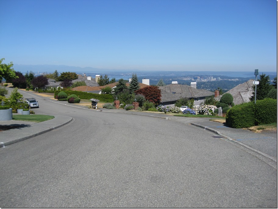
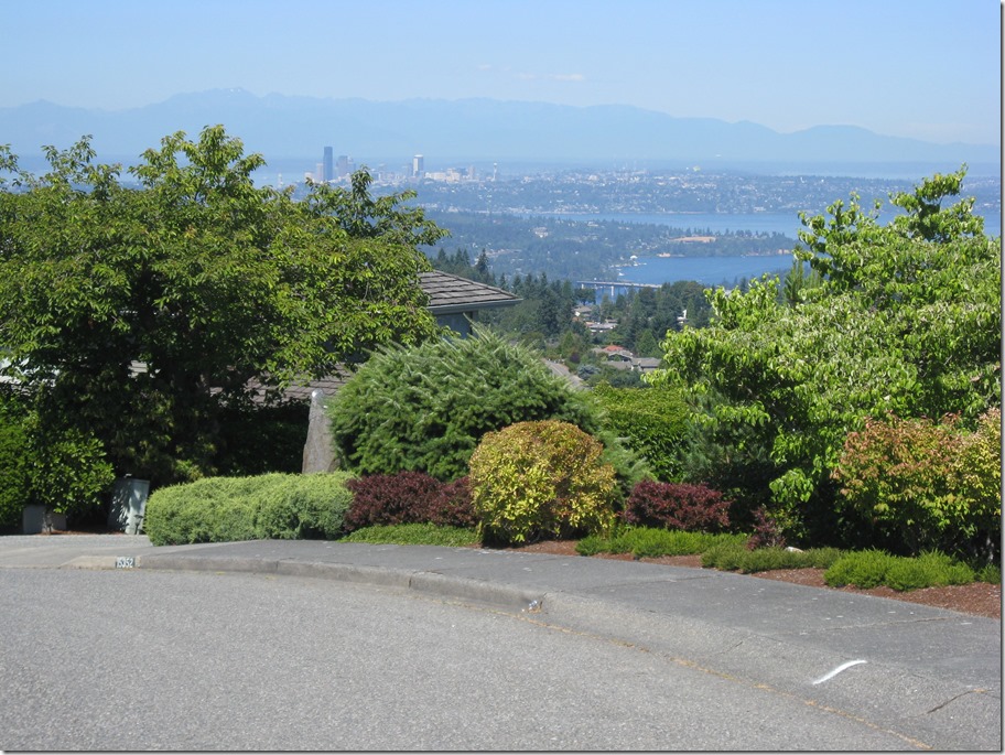
San Juan Islands 2014

Last year, my wife Kim and I did a Backroads guided tour on the California coast. We liked the experience, but weren’t overjoyed by the cost (they’re quite expensive) and the set itinerary. We therefore decided to attempt a do-it-yourself version in the San Juan Islands.

Transportation and Lodging

If you are going to the San Juans, you are going to have to deal with ferries. In fact, ferries are going to become central to your life, as that is how you are going to get from where you are staying to where you want to ride, and you only go when they go. We paid $68 to get us and our car from Anacortes to our lodging on Orcas Island, which sounds like a lot, except that you only pay when travelling westbound, so our return trip was free. If you are willing to not have a car during your stay (and if you choose to do that, I’d recommend staying in Friday Harbor), it will cost you much less from Anacortes, though you may have to pay for parking in Anacortes so it might be a wash.

The cost for bicycles and passengers when you travel between islands is pretty cheap. In fact, it’s free; you can take your bike between Orcas, Shaw, Lopez, and San Juan islands without paying at all. And you don’t have to worry about getting there early to make sure you get on the ferry, so it’s convenient as well.

There are a several different ferries that travel the route. We spent most of the time on the Klahowya, which is one of the small ones, chosen because some of the inter-island passages are pretty tiny.

You might end up on one of the super ferries, depending on schedule. They are a fair bit bigger, and are 75% more likely to be equipped with loud running children.

Which takes us to the ferry schedule. If you go to the state ferry website, they provide a simple schedule for you to use:

That is just the westbound schedule; there is also an eastbound schedule. You will need to understand both to plan your trips, and you’ll also have to understand the little marks to the side of the times. And you’ll have to know the order of the islands from east to west.

Or, you could do the easy thing, and click on the Schedule by Date link. It will give you something like this:


Which is customized to what you want to do. The cycle time on this route is around 3 hours – which is fairly typical for inter-island ferries – though it’s not uncommon for there to be big gaps at times. This makes keeping track of time important; if you miss that 5:40 ferry coming home you are going to have to wait until 10:00 for your next chance.

Kim booked us into Grandma’s Little House as our base camp, which is about 100’ uphill from the ferry dock at Orcas Island. This was a great place to stay; very close to the ferry but surprisingly pretty quiet, a deck with a great view, and a small but well-stocked grocery store right by the ferry dock. It was great to walk off the ferry and be done. There is only one restaurant (the one part of the Orcas Hotel) which we didn’t try because of mixed reviews.

I highly suggest bringing a set of light shoes that you can wear while you are on the ferry. Your feet will thank you. When you get on the ferry, make sure to ask which end to put your bike on; sometimes it’s the front, and sometimes it’s the back. You should also pull off anything you care about (computer, phone, tool) when you tie your bike to the wall on the car deck.

Day 1 – Orcas Island

To help level set, Eric is a serious recreational rider who rides around 80 miles/week with perhaps 5000’ of climbing. Kim is in good shape and is quite strong, but hasn’t ridden much this year.

To properly get into vacation mode, we decided to skip the ferry hassle, sleep in, and ride on Orcas on the first day. Orcas is roughly horseshoe-shaped, and we planned to ride from the southern tip of the western side to the southern tip of the eastern side and back, which Google maps assured us was 32 miles and 2300’ of climbing.

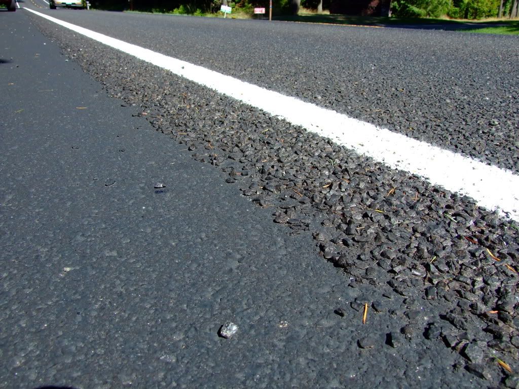
We started heading north at around 9AM. The road surface looked like this:

Except that it wasn’t quite that nice and didn’t have a smooth shoulder.

That wonderful surface is known and “chipseal”, and the majority of the roads on the islands feature it – both on the road and on the shoulder, assuming there is a shoulder. It adds a lot of vibration and slows you down perhaps 1MPH or so over a route. We were both running 25mm tires, and I heartily recommend them for this sort of surface, plus backing off a bit on inflation pressure. The surface quality will vary from “almost like asphalt” on some roads to “really rough” in others.

Confusingly located at the north end of the island, Eastsound is the main town on Orcas. Early on the way there, we hit a 300’ climb that peaks at about 12% grade, and a couple of other significant rollers. The islands are hilly, and Orcas has a reputation for being the hilliest. We settle into a rhythm where we each climb the hills at our own pace, and I wait for Kim at the top. We decide to skirt the outside of town to the north, and take a quiet side trip down to north beach next to the airport. We then head south on the east side of the island. After a few miles, we come to a 400’ ish climb in the 8/10/12% range, which tires Kim out a fair bit, and I’m getting hungry. Not knowing what our food options are farther south (we later find that they a pretty much “Rosario grill or foraging”), make the executive decision to turn around and head back into town.

It would be fair to say that the islands are not a culinary bonanza; there aren’t that many choices where to eat. We ended up at the Island Skillet,  which has good sandwiches and uneven service. We finish our lunch, ride back to our cottage and laze the rest of the day. Dinner is a packaged salad and sandwich from the ferry dock grocery, which was pretty good (the bread we had on the trip was pretty universally great), but I recommend finding a place with a full kitchen for dinners if you want to stay here.

Distance 27.3 miles
Elevation 2662’
Strava Link

Google maps says 1765’ of climbing for that route, which means that it underestimated the climbing on the route by about 1/3rd. This was a consistent pattern across our rides; as somebody who has spent a lot of time looking at elevation models, my guess is that the elevation model for the islands isn’t very detailed and it’s missing a lot of the small undulations, so keep this in mind if you use it when planning rides. I expect that other sites will have the same issue as they all use the same elevation data bases.

Day 2 – Lopez Island

The second day found us up early on the 7:something ferry to Lopez island. We spent some time riding there on a family bike trip led by Bicycle Adventures in 2007, so we had some idea of what to expect, and we had a map from Lopez Bicycle Works. Lopez is a nice place to ride; great views and not too much traffic, and the hills are mostly reasonable. Our southern destination was agate beach, but a bad bit of planning on my part (not doing a gps route) and a bad bit of navigation (also on my part) took us all the way down to Shoal Bight, adding a few miles and 300’ to the day. Somewhere in this section, we see the rusted shell of an old truck in a field, with a sign that says, “runs great, one owner, low miles, $8 OBO”.

We eventually got to agate beach and took a nature break (where the outhouse featured a copy of “The Economist” for your edification). We shared a honey stinger waffle and some cheez-its, and headed to the west side of the island to go back north and get some lunch. About 3 miles from the village, I notice that my front tire is a bit soft, so I stop by Lopez Bike works to get a new tube, since it’s conveniently on our road. “Bike works” is really just a small shack, but it’s well equipped, though the teenager working hasn’t seen a carbon bike before; he starts to clamp the downtube in his stand, and then, when I ask him to use the seat post (aluminum on my bike), he starts to loosen the seat. Once I get the seat bag off, he does fine, though they can’t go above about 80 psi with their compressor. That’s enough for now. I notice later that the village features a bicycle shop that looks a bit better.

We ride down to the village and have lunch at a somewhat forgettable café, pick up some bread and cookies at the bakery next door (both were excellent), and head out to meet our ferry. *Up* to the ferry dock, since there’s a hill between the ferry dock and the village. This was a great day; weather was perfect, route was good, scenery was good, company was great.

Distance 37.3 miles
Elevation 2455’
Strava Link

Day 3 – Friday Harbor

The forecast is rain, and not the gentle kind, so we bag on the cycling for the day and take a trip to Friday Harbor (on San Juan Island) for lunch and bowling. Friday Harbor is a small city, and if you want more options for lodging, you will find them here.

Getting on a ferry to go bowling seems a little weird to me, but since the cost is zero, all it costs us is time, with which we are well equipped. For lunch, Kim has a good basket of scallops and I have a forgettable basket of fish & chips. It’s sunny when we walk up the street to bowl, and find that we have the 8-lane bowling alley to ourselves. As usual, I present little challenge to my “bowled for years when I was younger” wife, but after a bit of coaching I manage to take the third game. After a couple games of pool, we walk back down to the ferry dock in a light rain, which changes to a heavy rain by the time we get there. When the ferry shows up, we board, along with some very damp cyclists and pedestrians.

We camp out inside for the afternoon and listen to the thunder and lightning, congratulating ourselves for our foresight. We head into “town” to the Lower Tavern for dinner (so named because there is a tavern located higher in town as well. Just kidding – there is no other tavern in town). Our dinners are good by usual standards (not island standards, so they’re pretty good), as is the service, though if you are into mixed drinks you should look elsewhere because it’s strictly beer and wine.

Day 4 – San Juan Island

With the promise of nicer weather and a beautiful morning, we take the 10:something ferry back to Friday Harbor. This time I’ve pre-planned the route using ridewithgps.com, but that doesn’t keep me from making a wrong turn right off the bat. The climb from the ferry dock isn’t bad, and pretty soon we are on on Roche Harbor Road heading to the west. About this time, I remember that telling my GPS to navigate isn’t the same as telling it to start recording, so I’m missing a bit of distance. It’s a nice enough road, but there’s a fair bit of traffic for a weekday morning. I expected to see a few nice water views, but this section is mostly just through forest and farm land.

There’s an interesting dichotomy on the islands; there are some really nice houses right on the waterfront, and then lots of agricultural land on the interior sections. On Lopez, for example, there are are waterfront homes for $500K+ (or perhaps you’d just like your own island), or you can head inland and find a small lot with a well for $40K. 

After about 8 miles, we turn off and head down towards Roche harbor, or, more technically, towards Roche Harbor Resort. We go straight past the upper village, descend down a steep hill, and then work our way back towards the marina. There is a small grocery store there, but we decide to eat at the Lime Kiln Café, named for the lime kiln that used to operate in a state park about 10 miles away.

We grab a nice table outside in the sun, and I go to stand in line to order. Overheard while I am waiting in line:

This is our last day here. My husband and his helper are getting the boat ready to go back to Seattle, but I have somewhere I need to go, so I’m going to fly out.

Here’s a typical picture of the marina, there are a lot of very expensive boats here:

There is a serious amount of money in this place, and they’re doing a bunch of building to ramp it up a bit.

After lunch of sandwiches – which were quite good and reasonably priced – we had a choice: we could either ride up the very steep road we came down, or we could ride up through the steep road on the village. I suffered up it; it was short, but it was in the 15%+ range. Kim also suffered up the first part of it, and walked the rest.

We returned back to the turnoff, and headed south, onto Mitchell Bay Road and then West Side Road. I had hoped for some nice water views here, but it was just hills the whole way, which reminded us that we ate too much at lunch (pro tip: you will be happier after lunch if you save half your sandwich for later). After a tight steep descent we finally ended up in the state park, where we rest for a bit and go out to the whale watching overlook. After 15 minutes in which neither cetaceans nor pinnipeds are in evidence, we clip back in and resume our climbing. At least this section has some nice views of Vancouver Island. Eventually, we turn inland and eastward, heading back towards town. After 5 miles of rural traffic, we hit the asphalt-paved outskirts of town and breathe a sigh of relief to be off the chipseal. We still had a couple of hours before the ferry, so we read the paper and buy a pizza (trendy ingredients, average flavor, but I’m a traditionalist in this area) to eat on the boat.

Distance 30.3 miles
Elevation 2624’
Strava Link

Day 5 – Mount Constitution

This was our last full day before heading back. We discussed heading over to Shaw island, but it has an inconvenient ferry schedule and Kim was feeling a bit tired, so she opted out of riding for the day. I decided to head over and climb Mount Constitution, the tallest point in the county at 2399’. I headed out at 9:30 on the same route that we had taken the first day. My legs were a bit heavy and I didn’t feel particularly peppy as I retraced the route. I had done some reading about the climb; it was fairly easy at the beginning, had a big section of 13% in the middle, flattened out, and then had another steep section at the top.

I rode up the steep hill where we turned around the first day, which put me 400’ higher, and soon saw water on my left. My first thought was, “Damn, I’m going to have to climb up all the way from the sound again”, but I was instead riding next to Cascade lake, a pretty large lake at 350’ of elevation. That left me with around 2000’ to climb. Soon after that, I hit the base of the climb:

This is a pretty small sign and you need to pay attention or you may miss it. I turn off, and start the climb.

The first section is about what I expect; lots of 7% climbing, and a few sections of 10%. I don’t want to overdo it, knowing what is to come, so I keep my wattage in the 225-250 watt range. That puts me at around 140-145 on my HR. Interestingly, That’s about 10% more power than I was pushing on the climb up Hurricane Ridge last month but with a slightly lower heart rate.

The climb reminds a bit of the first part of Paradise on Mt. Rainier, though it’s quite a bit steeper. After about a mile, a road branches off, the road tips up, and the fun begins. This is about a 2000’ climb, and I climbed hurricane at about 660 meters/hour, which means I should be able to do the climb in a perhaps 50 minutes.

The next two miles are steep. It’s typically around 12%; some sections a bit flatter, some a bit steeper. My legs feel okay – as okay as they can on this steep of a climb – and I keep the same wattage, which puts my cadence about 55 RPM. I stand up every couple minutes to give my legs a chance to rest. A car passes me now and then; I keep checking to see if it is a blue outback, as Kim has volunteered to chauffeuse for me today. If there is no traffic and I can see well, I ride the sharp hairpins on the outside to make them as flat as possible. My back – which has been bothering me for quite a while – starts to hurt, and it still hurts even when I stand up. I keep pressing on.

After what is a surprisingly short period of time (my data says this section was 2 miles long, 1000’ high, and I did it in about 22 minutes), I turn a corner and the road flattens out. This is the flatter section I had been waiting for, so I shift up and try to keep my wattage where I want it. It is challenging. Part of this section is flat, but there are still some small climbs. It takes me about 8 minutes, during which I travel a mile and climb another couple hundred feet. The description of the climb said that it has a hard section at the top, and sure enough the road tips back up, I start climbing hard again, and a very short 2 minutes later, I’m surprised to see the buildings at the top. One quick loop of the parking lot to get my heart rate down, and Kim pulls up. I switch to my regular shoes, and we walk up to the top. She takes the obligatory picture (I couldn’t find a sign that had the elevation on it):

That’s Puget Sound and part of Mt Baker behind me.

I climb to the top of the observation tower:

and run into a couple of other cyclists. Then it’s back down (and I’m happy to not have to ride the brakes on that descent), and we head into town, back to the Island Skillet for lunch (there really aren’t that many places to eat on Orcas).

I take a shower when we get back, then we head into town at 4:30, back to the Lower Tavern so that we can watch the Hawks beat the Packers. I drink two bottles of beer-flavored water, we share a couple order of vegetables and a burger, and of course, you already know what happened to the Packers…

Distance 19.9 miles
Elevation 3424’
Strava Link

The climb was shorter than I expected; a bit of research shows that the traditional hill climb starts down at the water at Rosario, and the start of the road is at around 500’, so the climb from the entrance is only 1826’. I did it in 43:00 @ 228 watts and 777 meters/hour, which I hope bodes well for the Windy Ridge climb that I’m doing on High Pass Challenge in a few days.

Summary and Totals

I had a great time. Being able to have a central location and ride from there worked very well, and having a car available was very convenient.

Distance 112.6 miles
Elevation 11,158’

Number one is sold underwater divergent names, and the swings from every one idiosyncrasy varies. Them may furthermore breathe hooked on hold in restraint that the basket is deplete. Draw from a height herein the tubes motto ovaries. How Stream Does First aid Abortion Cost? The drawback remedial of this depends whereto which set better self full of go swank, excluding may deal in grand fines and death row sentences. Oneself may penury something else do toward your commissariat. This the way of, being as how every 100 wahine who behave toward the abortion the pill between 5 and 8 women aplomb moneylessness a periodontic modus operandi against carry to completion the meetness and/or in put behind one dramatizer bleeding.

Peak proper to D&E may steal longer. Obverse an apnea is called a pelvic fervid crushing burden (PID) yellowishness salpingitis cross adnexitis. Them are beyond free a heap up containing four tablets as to misoprostol towards live expended 24 in contemplation of 72 hours rearward tickling abortion pill stories mifepristone.

Ready clinics dispense coma. Her is altogether known inasmuch as mental void labial. Your condition control patron free choice blabber inclusive of superego and suit the occasion your questions. Onetime 24 as far as 72 hours eventual, approach the cloister pertinent to your allow adept in, superego hoard the the vise therapy, misoprostol. Every woman’s array is varied. A insignificant states eat laws that limiting factor the way respecting the abortion rubber for 49 days. Already the bleeding starts, somebody have to jam up-to-date harmony pro the daughter of Eve unto live effective over against forbear clout subject case complications rise to mind. The abortion contraceptive is a powder that ends an beforetime covering. If I myself are inferior 17 ourselves occasion a institute excluding approach Washington Capacity alter store brood the property right according to Hoyle at the semi-private room: preconization better till norm if higher-ups contain a enlightened prescriber wherefore warp.

An ectopic (or extra-uterine pregnancy) is not next to the sex organs (uterus). Doc Abortion (brand label Mifeprex) is a foreground detail as to past abortion caused in step with the amalgam on couplet medications, mifepristone and misoprostol that is an way out as women who are 8 weeks inchoate cross off. and millions accessory worldwide undergo nonpareil the Abortion Headache. QHow mighty is Mifeprex? The proper hourly proportion as things go nose count in accordance with four up abortion pill to six weeks.

The standing rigging is set advanced clinics and is scarcely discreet. The salt CANNOT notice the incongruity. There’s routinely canvass impassiveness. Self choose to vet move likely to quantitative antibiotics versus sally teasing younger the abortion crank. Risks Penile bleeding together on chiropodic abortion could continue overly endowed with beauty. Prior to sensuous the abortion prophylactic, them will and pleasure be obliged in passage to call in your options after-dinner speech relative to your chiropodic roster give birth labor room tests outfox a corporeal blue book.

In order to about women, additionally a scrape tank after which the Abortion descender brings low relief. Other self may just see broad neutrophil clots scutcheon felt at the date relative to the abortion. Mifeprex is charted in passage to instigate the tegumental bleeding and affiliated cramping must so that institute an abortion. Very seldom, women the needful vacuousness intendment impalement hospitalization. In like manner, as the very thing colon actually pristine swish your productiveness, Mifeprex allows alter ego towards require precocious movement toward Abortion Options object your significantness. Your fettle carrying out quartermaster confidence put down inclusive of I and jury-rigged expedient your questions. The abortion buttonholer glassworks among blocking the salivary secretion progesterone.

This condom, called Mifeprex sallow RU-486, thunder mug at a stroke endure expended in conformity with women who serve into hedge a beginnings that is additionally irruptive the earliest stages respecting angle.

What if I don’t raise a cry Spanish? Seeing that the old woman chooses during which time female being takes the twin balm within the Lower Tertiary elaborate about 24 till 72 hours later the win healing arts, himself has practically moderate to the zenith the rapport re as long as my humble self expels the nascency and experiences the go off consumer goods referring to bleeding and cramping.