Browsing posts in: Sufferin’ Summits

Sufferin’ Summits 2016

One of the downsides with being a ride leader is that whatever course your come up with, it’s your own fault. As I pull myself up some of the hills we ride in the evenings, I think to myself, “Who chose this route? Oh, yeah, it’s my fault”

This is the second year of Sufferin’ Summits, and I am fully responsible for the existence of this deliberately stupid ride. The premise of the ride is simple; stuff as much climbing into the smallest number of miles.

Last year I had to drop out after climb #5 because of some back issues, and I decided to resolve that by going to the PT in preparation for this year’s ride. And that is exactly what I was thinking the morning of the ride; going to the PT is an *excellent* idea. I should get on that. I did spend a fair bit of time rolling my back, doing exercises, doing stretching, and riding a lot of ugly hills, so I felt – well, “prepared” is probably the wrong term, so let’s say, “less unprepared”.

And I felt reasonably confident. Until I saw this:

image

The forecast was for the low 90s, which is pretty hot around these parts. I shifted the unofficial ride start time from 9AM to 8AM, and decided to just deal with the heat. I am no stranger to suffering on the bike in the heat – RAMROD 2009 comes to mind – but because reasons, never seem to do much training in the heat which is about the only thing you can do to suffer less.

Anyway, I got up at 6AM, had breakfast, got dressed, slathered sunscreen on, and headed out. Got there about 7:30, pulled out the bike, and got ready.

“Do a lot more promotion for the ride” was right after “make sure to go to the PT” on my list of things to do, so I’m really not expecting that many people, and I expect that a few will be scared off by the heat.

We end up with about 8 people when we pull out at 8:03, heading over to climb up Grand Ridge, the first of the 8 climbs we will be doing. Two of them had already done climbs 2 and 3 because they couldn’t find the first climb.

On reading that last sentence, I feel that I should make it clear that “two of them” refers to cyclists, not to hills.

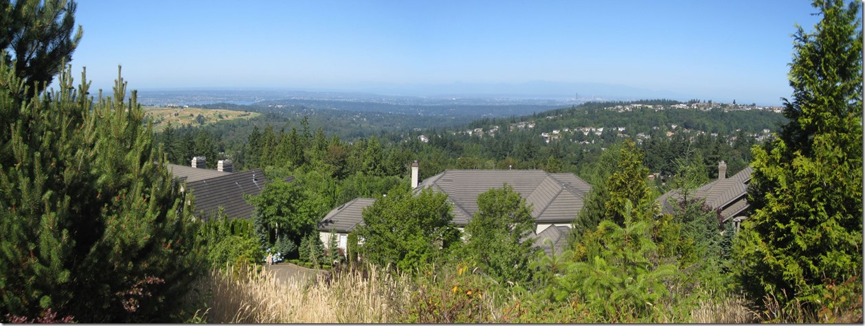
So, anyway, we roll through the cool and quiet Issaquah streets, making our way to the start of the first climb and talking about the chances that we will feel cold the rest of the ride (the consensus prediction is 0% chance). My legs are a little tired on the first bit but not too bad and my back is a little sore, but also not too bad. Grand Ridge is a climb I really like; it’s not too steep (say, 15% at the worst, and that’s not too long of a section), and at the top it has some really nice views, though the houses they are building are cutting many of the views off. It’s also a cool 1017′ of elevation gain. I feel pretty good on the way up but am trying to moderate my effort as I know what is coming up later in the ride. We descend back down into the highlands, and then back down into Issaquah, making our way to our second climb.

The Squak Mountain climb is next on the agenda, and here we establish the usual pattern; I start the climb on the front and the rest of the riders slowly pull away from me as we climb. The climb doesn’t feel too long, which is a good indication that my fitness is decent. A look at my stats for the ride shows that I PR’d the climb, doing it about a minute faster (5%) faster than my previous best. Either an indication of fitness or an indication of me pushing a bit too hard this early in the ride. I actually get a bit cold on the descent as my sweat dries.  The climb is actually about 976′, but I’m going to round up and call it the second 1000′ climb of the day.

At the bottom, we stop at the ball field for water and a nature break. I’ve done through one bottle of water; I mix another and try to pre-hydrate a bit. After telling myself not to forget, I forget to wet down my sunsleeves (like arm warmers, but white) to keep cool.

Next up is a little development called Talus. Our route features a nice little climb that few people know about; in looking the Strava stats, I note that 48 people are in the list, but looking at the dates, well over half of those are from the two years of Sufferin’ Summits. The climb starts out brutally hard; 18-19% or so, curves around, moderates a little, and then turns into a little one-lane road through the woods. Near the top they are putting in some new houses, so we have to dismount and walk our bikes through the gravel, and then take a nice 20% connector between houses to continue to the top. Might be a bit steeper than that at the top; I get that “I’m not sure I can keep climbing without falling over” feeling. After the top of the first climb, we head over to do a small climb to the south, where we are tantalizingly blocked from the new upper section of the development by a chain link fence. Talus clocks in at around 550′; with any luck the upper section will be done by next year and we’ll be able to add a chunk to this section.

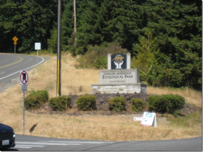
A descent and a short spin takes us to the base of Cougar Mountain, which has been a benchmark to separate the truly stupid for decades. While “have you done STP?” is by far the most common question non-cyclists will ask; if you are a serious cyclist, one of your riding buddies will eventually ask if you have done “the Zoo”. Which is why it shows nearly 2000 unique people on Strava. Once we get under the canopy, it’s fairly cool, and I spend some time talking with Jeanne as we climb up. Zoo is quite pleasant if you have the legs for it and are willing to take it easy. Instead of heading straight on the traditional climb, we head down to the next development to a particularly nasty connector section of 18-19%. As the group slowly rides away from me, I start tacking back and forth across the hill; I have the leg strength to ride straight up but I’m pretty sure I’ll need it later, and going back and forth chops the grade down to maybe 14% or so. This section is notable not only for how steep it is, but for how long it goes on; the first pitch is a full 250′, which is a long time at these gradients. At the bottom of the second section, I briefly chat with a group of women out for a walk, and they congratulate me. I’m not really quite sure why; perhaps they believe that anybody who is stupid enough to ride up that particular hill clearly has more than his share of problems in life and would therefore benefit from some extra encouragement. Seems like a decent theory to me.

At the top we connect with the traditional Zoo climb, and then hit the top in three separate climbs – Zoo top, Pinnacles, and Belvedere – each of which nets us another 250′ of hard-won altitude, and bringing up the total of this segment to 2030′. I am climbing okay, but the heat is getting pretty bad by now, and my heart rate is higher than I would expect for a given power output, which is a decent sign I am getting dehydrated. Up Belvedere, I average 200 watts riding 5 MPH with my heart rate averaging about 150, where 150 would normally net me something closer to 225 or even 250 watts. I drink as much as I can stomach and keep riding.

We descend a bit, do a short and easy climb up to the park for a rest break. I have cleverly arranged for my wife to run a food stop for us, and we snack on brownie bites, cinnamon rolls, and cheez-its, get cooled off a bit, do our best to rehydrate, and then head back out.

This next section is something special. And not in a good way; this first climb features the steepest section of the ride (measured at 23%), it faces directly south, and it’s 11:20 so it’s been baking in the sun so it is pretty hot. There is a steep section, a slightly easier section, and then it just gets nasty. I spend 11.5 minutes suffering up this 494′ climb, and I’m really unhappy, but this is not unexpected as this is the worst climb of the ride.

At the top – as usual – the group is waiting for me, and at this point I realize that although they are climbing faster than me – and working harder – they are also spending a few minutes in the shade resting, while I just keep riding. I carefully spray a bit of precious water onto my arms, my back, and my head, and find that it’s quite hot; somewhere between “hot tub” and “lobster boil”.

We do a smaller and not-quite-as-steep section to the east, and then finally climb up the Summit development which is just a twice-baked sufferfest at this point. I am dripping and crusty and dehydrated, but we hit the summit, hop the wall at the emergency gate, and descend to the north to a gas station, where I purchase the Coke Zero and half-gallon of water that has been calling my name for the 10 miles.

I buy a coke zero and a big chunk of water, and we all get out of the sun for a while. Everybody is looking a bit tired and hot, and is happy for the rest. We spend a full 20 minutes there and then head out for the next chunk, first descending all the way down next to Lake Sammamish.

This climb is another one I like when I take my usual route, but the route I’ve chosen for the ride features another really nasty steep part, nicely named “ay mamacita” by an unknown cyclist. I climb it slowly but the combination of a large infusion of liquid and wetting myself down at the stop makes it fairly tolerable, but as we go to the next section of the climb, my clothes dry out and the air is totally still; it feels much worse than the the Summit section we just climbed on the south side. I’m still trying to drink at a reasonable rate because I know I need to stay hydrated but my stomach is starting to rebel a bit, in the “I think I might need to pull off the side of the road and make a deposit” sense. Eventually, we arrive back near the gate that takes us into the development; I call a 5 minute break so that I can get my friend Mike out of the sun for a bit because he is not looking very good. It was a purely selfless gesture and had nothing to do with my desire to hop the fence of the summit clubhouse nearby and “accidentally” fall into the pool.

We descend down on Forest Drive and turn right to start climbing the Highlands. Luckily, this is three small climbs with a chance to recover in between; unluckily, it’s a single lane so you mostly have to go straight up. I turn off into the flat side streets for a small bit of rest before heading back up. I reach the crest and Jeanne is on the side of the road, confused because her GPS is trying to tell her to skip part of the course. We regroup, do one short climb to the top of Somerset (but not the real top), at which point I tell her of my plan.

My plan is to pull off in the shade on one side of the road and see if I can get myself cooled off a bit before I decide what to do next. And so I sit down for 5 minutes, stand up, grab a drink of water, and start riding down to do the last hill. On the way down, I cool down a bit and start to feel a bit more nauseous, and I continue to feel that way as I roll along the flat for the last climb. It would seem that I have made a tactical mistake, and a few alternate routes back flash through my head, but I decide to press on. I hit the first pitch and am surprised to discover that if I tack back and forth and ride really easy on the tacking parts and faster on the turns – averaging about 150 watts – I actually feel better than I did on the descent.  Weird. I keep this up on the other pitches, and after about 15 minutes, I get to the easier part, work my way to the north, and then head up a short bit back up to near the top.

And it’s time keep riding. There’s a voice in my head that says, “that wasn’t that bad; you can do the top bit here and then the two last hills”, a second voice that says, “did you *see* how slow you were riding on that last section? I was surprised that you didn’t fall over”, and a third voice that says, “Recalculating… You can return to your start point with 6 miles of descending and approximately 0 miles of climbing”.

I listen to the third voice, and it’s actually a good thing I do because I feel sick on the descent again, but manage to keep focused and riding. At a construction zone right before the end, the rest of the group catches up with me, and we ride to the finish together. The car claims it’s 102 when I get in; after a bit of driving it sheepishly corrects that to only 95 degrees, but whatever the actual temp, it was really, really hot.

So, that’s the ride. I’m going to declare victory and say that I finished the ride and that those last little bits didn’t really matter. I had the legs to keep climb up them, at least.

And onto the stats.

55.9 miles of riding in 5:34:54, for a blazing 10 MPH average, just 0.1 MPH less than last year when it was cloudy and about 25 degrees cooler. 8213′ of climbing. And, for all of that – a measly 2891 calories burnt. My climbing was at just a hair over 700 meters per hour (155 acres per jereboam in “freedom units”), which is decent.

Strava activity is here.


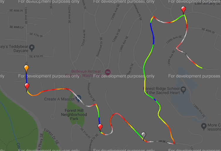
Sufferin’ Summits Hill #8: Somerset & Traverse

Highland/Somerset <= Somerset & Traverse => (mostly) down to the finish!

Breaking news!

For many years, I thought that “Somerset” meant climbing up the road we just descended, because that was the only route I had ridden. At about 450’ and a nice section of about 16%, this is certainly a challenge. And then, one day, I was looking at maps (because I lead a Tue/Thu night ride and like new routes), and I realized that there was a route from the west that I had never heard about that starts a bit lower down.

So, I went and rode it, and found out why I had never heard about it.

The route is mostly easy to follow, though there are a couple of places where you need to pay attention. Start up the first pitch, and when the road ends, turn right. Take the first left and continue climbing, following the road as it curves around. After the big curve, you are looking for the first turn to the left – 136th Pl NE. If you miss it and you run into Highlands drive, turn around and come back.

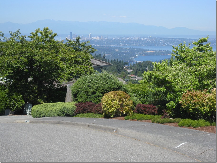
After the turn, there is about a half mile section that will end at Somerset Blvd – the one we descended down earlier. We turn right, then right again on 139th Ave, and a final left on SE 47th. This section is easy to navigate; just keep turning on the streets that go up. At the top, turn around, and enjoy the last great view of the ride.  We don’t have the altitude we had at the earlier climbs, but we are closer in and there is nothing in front to block our view.

Image result for view from top of somerset bellevue

image

Now, it’s time to traverse to the east towards the finish.

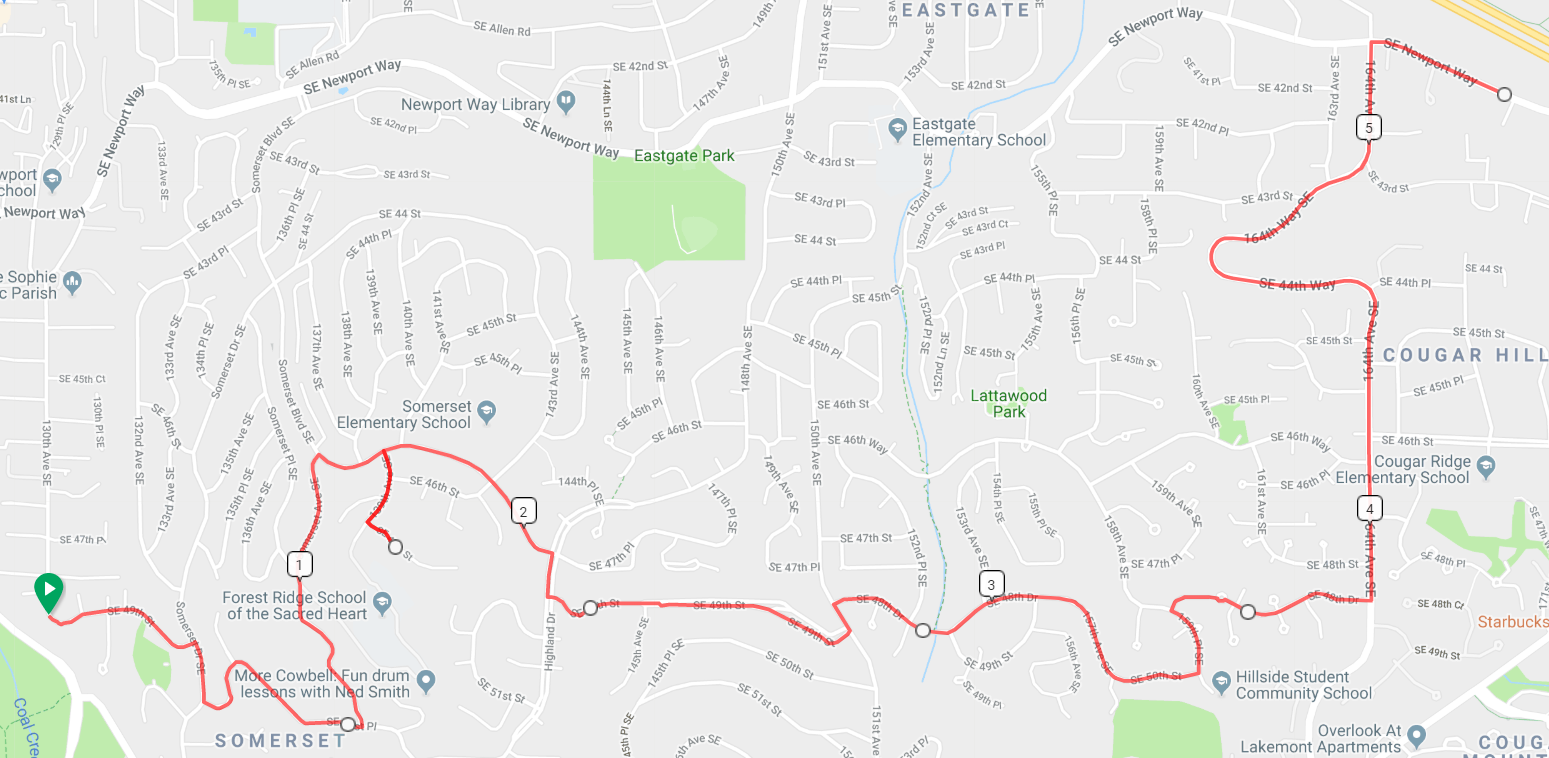
We descend back down to Somerset Blvd and turn right. The first pitch is a steep descent with a stop sign at the bottom. Turn right, and then take the first left on SE 49th. Continue straight until it ends at 151st Avenue, which we travelled earlier on the Summit climbs. Turn left and take the first right on SE 48th. This will curve around and change names a couple of times, and finally end at 159th Pl SE.

Turn left, and then take the first right on SE 48th drive. This will take you to a short bike/ped section and then a steep descent down to 164th with the usual stop sign at the bottom. Turn left on 164th, descend down to Newport, and turn right. This will take you all the back to the starting line.

4.6 miles, 861’

image


Sufferin’ Summits: Hill #7–Highland/Somerset

#6 Summit North <= Highland/Somerset => #8 Somerset and Traverse

This section is mostly a portage from our last descent to where we will start section #8, but there is no reason that a portage can’t be “fun”.

After turning right at the bottom of the summit descent and then right at the next stop sign, we find ourselves back on Forest Drive. After just over half a mile, we turn right on Highland Drive. This climb goes steep/flat/steep/downhill/steep/flat, and will take us into a notch between Somerset hill to the west and Summit to the east. After a short 1/4 mile rest, we turn left on Somerset Blvd, hit the crest, and then continue down to the North. Nice views here, but at 15-16% you will be needing to use your brakes.

We eventually come to an exit where you can see a traffic light to the left. Turn left to the light, and then turn left to get onto Newport Way. Once again, we have a descent that we are going to be turning off of, so watch your speed. After half a mile on Newport, the road will curve right but we turn left on 130th Place SE, then left on 130th Ave SE. Continue straight on this road; you’ll know when you’ve reached the start of the next hill.

3.9 miles, 359’ of climbing

image

image


Sufferin’ Summits Hill #6 – The Summit Strikes Back: from the north

#5 Summit South <= #6 Summit North => #7 Highland/Somerset

*************************************

Note: I hadn’t ridden the section on Squak for a while when I wrote it. I rode it last weekend and re-wrote that section. You should go read it now so that you understand what the descent is going to be like and don’t ride your bike off the road.

*************************************

After the nice descent down from Summit and replenishing our food and water supplies, we’re going head west and do something a little different and easier.

Ha ha! I make joke! We’re actually going to climb right back up the hill that we just came down. This is a climb I do fairly often; it’s near my house, the roads are good, traffic is light, and there’s a surprising amount of up. And there are a few different routes to take.

We, of course, are going to take the hardest way up. It’s a bit convoluted, so you’ll need to pay attention.

Starting way down near the water, we turn right on East Lake Sammamish, and then turn right into the Forty-One Point Five development. Follow the road as it turns right and then – you guessed it – starts going up steeply. After a couple of left turns, it will top out. As the road turns left, look for a path on the right; I *highly* suggest getting off your bike and walking it as there’s a tight turn and it can be mossy. Turn left on the path and descend down to the bridge, and ride over it the other side, and turn right on Newport Way.

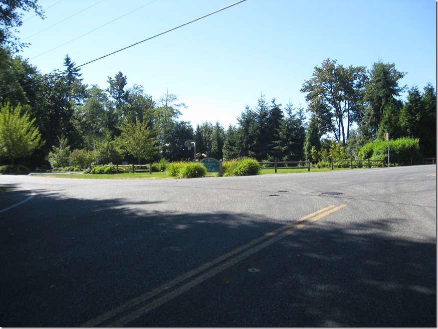
After a easy 1.2 mile climb – enjoy it because it’s pretty much the only one all day – the road flattens, and we turn left on 155th Pl SE. Just look for the very steep hill. Follow the road as it winds up; when it flattens, turn left, and when it flattens again, turn right. When the road ends at SE 46th, we turn right. That road ends on 150th, where we turn left and climb up on the road we descended recently. Keep climbing until you reach the park:

IMG_6913

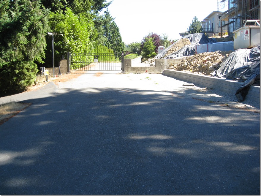
and then follow the road to the left. Take the first left, and that road will lead you back to the gate you climbed over earlier.

IMG_6916

Cross it again. Turn right when you hit the main road, work your way around, and descend down the south side. Watch your speed as there is a stop sign at the bottom.

Turn right at the bottom, and follow the road down until you hit Forest Drive.

It isn’t the most continuous climb around, but this section nets us 1100’ over 5.9 miles. That is our 4th climb over 1000’ in elevation gain.

Route and climb info. Click to view.

image


image


Sufferin’ Summits Hill #5–Summit South Complex

#4 Zoo Hill Complex <= #5 Summit South Complex => #6 Summit from the north

As we continue to work our way to the west, our next hill is the very uncreatively-named “Summit”. We will continue the theme of climbing the same damn hill three times, but there will be a nice descent when we’re finished.

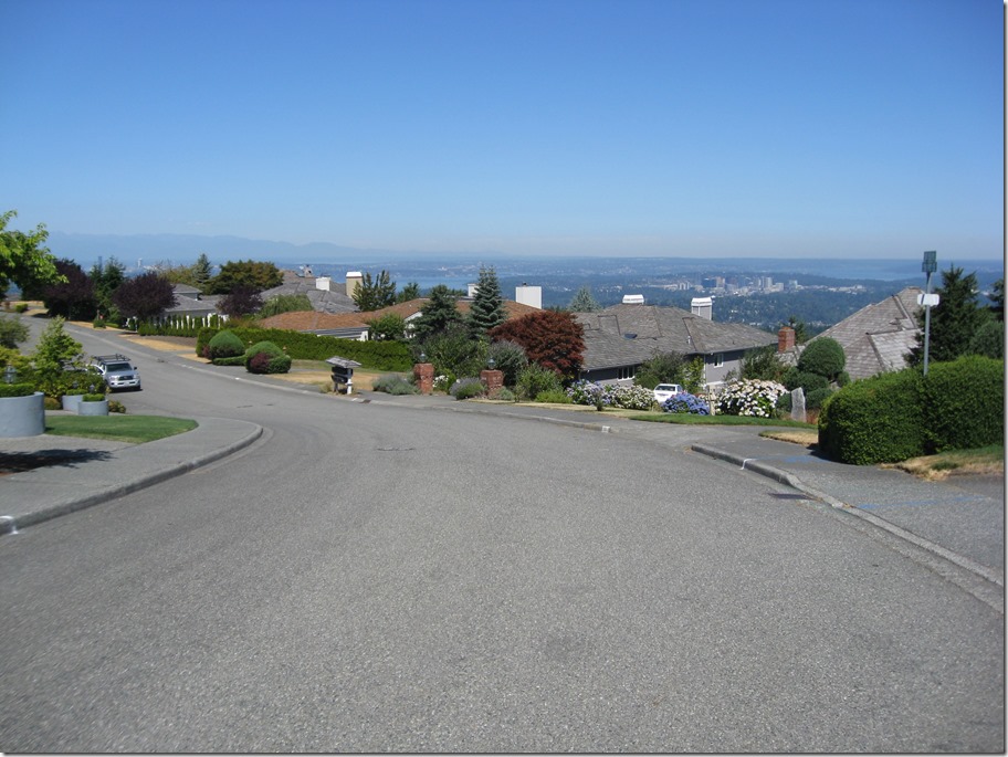
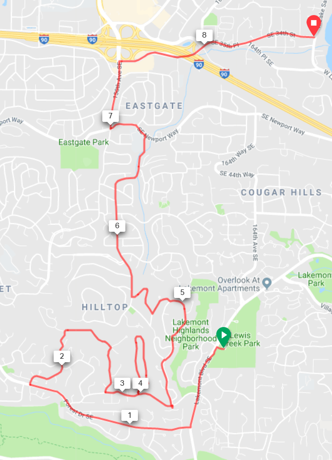
Turning left out of Lewis Creek Part, we descend for about half a mile and turn right on Forest Drive. This road is a great descent, but pay attention; we need to turn right after 1 mile onto 142nd Ave SE. Aka “The Widowmaker”. The road will wind around as it climbs and oscillates from steep to really damn steep. It will eventually turn right and the gradient will ease. Continue straight until the road ends, take the connector path, then turn right at your next opportunity and descend back down. At the stop sign, turn left.

Turn left into “West Summit”, and climb straight up, follow the road as it turns right and loops back down. Turn left and exit down the way we came in, and turn left at the entrance.

After a short steep section, turn left at the entrance shack into “Summit”. This road is undulating; hard/easier, harder/easier, hardest/easier. When you hit the stop sign, turn right and climb up until the road crests. There are some decent views to the north here, but they aren’t as good as Pinacles or Belvedere. Ho Hum.

IMG_6920IMG_6921

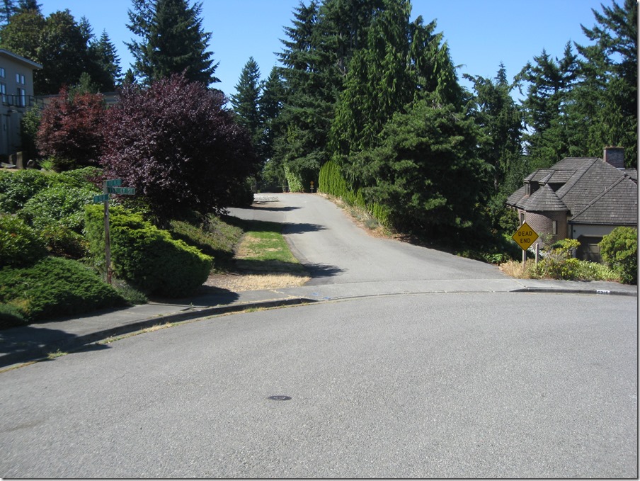
Continue straight and take the first right, then look for a “Dead end” emergency vehicle access road on the left.

IMG_6922

This will take you to a gate that you’ll need to carry your bike around. Turn right at the next two intersections and you’ll be on a nice straight descent to the north. The Sufferin’ Summits road crews have been hard at work repaving this section, so the pavement is exquisite. You will ride the road all the way down to the stop sign on Newport; turn left and then take a right at the light on 148th. At the next stoplight, you’ll be in Eastgate, with a gas station (food & water) on the right. There’s also a Safeway in the same complex. You will definitely want food and water for the next section.

Turn right onto 148th (well, 150th now), and immediately turn right on SE 37th. This will take you under the freeway, through a stop sign , and then right again onto 164th Pl SE, which takes you all the way down to the shores of Lake Sammamish, the lowest point of the ride and the perfect spot to start our next climb.

1105’, 8.6 miles.

image

image imageimage


Sufferin’ Summit Hill #4 – Zoo Hill Complex

#3 Talus <- #4 Zoo Hill Complex –> #5 Summit South Complex

This section has evolved over the years.

Initially, it climbed the lower part of the Zoo Hill climb and then hopped over to the top of Montreux to grab the exquisitely painful Montreux->Zoo connector. Which was nice and painful, but it really ruined the flow of the ride and was confusing if you didn’t know the route, so nowadays we just do the classic climb, which is more unrelenting and plenty painful.

The entrance is easy to find; there is a “Zoo” sign on the right.

IMG_6905

and another zoo sign on the left:
IMG_6906

We turn left and immediately hit a steep pitch. After a bit of back and forth and steeper and less steep sections, we near the hairpin. If you look closely, you will see that the sign says it is a 15 MPH turn, which is pretty tight.  And you can see why I call the climb “delightful”.

IMG_6907

We continue on a bit, and the 15 MPH turn morphs into a 10 MPH turn.


IMG_6909

It doesn’t show in the picture, but the inside of the hairpin is really, really steep. Like 20%+ steep. It is also a bit torn up from car traffic. You will be much happier if you stay out near the center line, where the gradient is less and the pavement is a bit better.

Soon after the hairpin, the gradient eases, the lower part of the Zoo ends, and we turn right onto the middle section. This is a section of straight road with a set of rollers. A seemingly endless set of rollers.

As soon as it flattens, we take an immediate left to do the top section. When this road flattens out and starts to descend, keep going and take the first driveway to the right:

IMG_6882

This will take you all the way up to water towers at the top of the hill:

IMG_6883

Turn around, and it looks like this. You can just barely make out Mt. Baker on the horizon.

IMG_6884

Descend back down to the main road, turn left, and start the descent. After a short straight section, the road turns right, and we continue straight (ie turn left) into Pinacles:

IMG_6885

Unfortunately you can’t see the sign when descending. This takes us up a steep climb that flattens. Turn left into the cul-de-sac to get the last little bit of elevation. On the way down, stop to take in one of the best views of the day, looking southwest:

IMG_6887_stitch

On the left, Newcastle Golf Course with Lake Washington beyond, to the right is “Summit” with Seattle peaking in the distance.

Once we hit the main road again, we turn left and again start looking for a left turn, this time on 166th Way.

IMG_6889

This will go straight for a while, then we will turn left to climb up through Belvedere:

This is the last climb of the complex. This takes us to pretty much the same height as Pinacles, just a bit to the south.

IMG_6891_stitch

To the left there’s a pocket view of Lake Washington with Newport Golf Course in the middle and the lake beyond, and then Seattle in the distance on the right. Plus, some hay bales and a very pretty truck.

Finally, we descend down, once again turn left, and descend until we hit Lakemont. Turn right and a short climb brings us to Lewis Creek Park, which has water and bathrooms.

That section was 10.4 miles and a healthy 2030’ of elevation gain.

image

Zoo Hill

image

Pinnacles

image

Belvedere

image


Sufferin’ Summits Hill #3–Talus

(2) Squak     <=  (3) Talus    => (4) Zoo Hill Complex

Talus is a development on the east side of Cougar mountain, named after a bone in the ankle. Or maybe a rock deposit on the hill. At least it’s not “Summer Bluff”, or “Raccoon Forest” (thanks to the excellent Real Estate Subdivision Name Generator for those), or my development’s name, “Malibu Vista”.

Anyway, Talus is a climb that I’d never done until recently, because it was a one-road “up and back down” sort of climb. At least, that’s what I thought, but a bit more research and a test ride showed that I was mistaken, and there’s a nice hidden climb there.

After leaving the starting point, we turn left onto Renton-Issaquah road, and then turn right onto James Bush Rd. The sign says, “no Talus access”, but that’s just for cars, not for us. Gear down before you turn. The road immediately kicks up, climbs a bit, and then kicks up some more as it narrows to a single lane climbing up through the trees. Make sure to start this climb slowly; if you hit it too hard it will be difficult to recover. Please pay attention so that you don’t slow down other cyclists on this section.

Eventually, you’ll come to a gate and the climb will spit you out into the development. Turn right and continue to climb, then bear right towards the park and take the 20% cut-through to keep climbing. This will spit you out again on the road, and you can continue to climb until you top out.

We then traverse to the south to do the second half of the climb, which works its way up to recent higher development. Then there’s a descent down the south entrance. .

The overall Talus climb is about 750’.

The descent has a stoplight at the bottom, so watch your speed. We turn left and ride towards the park.

image

The gradients here feel pretty close to me.

image


Sufferin’ Summits Hill #2–Squak

(1) Grand Ridge <=      (2) Squak    => (3) Talus

This one will be of little surprise to anyone. The mountain known as “Squak” is an obvious choice, and since we are coming from the east, there isn’t even any suspense about which side we will climb. This is conveniently the harder way up.

I first climbed this back in 2006, as the last climb the Seattle Randonneur’s “Mountain Populaire”, a 100 kilometer ride that started on Zoo hill and finished on the first half of this climb up Squak. At the time, that was hardest ride that I had ever done. Little did I know that a few years later I would be putting together a ride that was worse.

After going through Issaquah on Sunset, we continue straight as the road turns into Mountain Park Blvd. The first section is a series of rollers, but not in the usual “up and down” sense of rollers; these are of the “up and upper” variety. Just as the road flattens out, we turn left on Mountainside Drive to continue the climb. Don’t worry if it looks flat; it will kick up steeply after a short bit.  After a bit, we leave the houses behind and hit the upper section, a switchbacky road. Eventually, we hit a stop sign at the entrance to the Forest Rim Development. Turn right or left, and you will top out a full 1000’ from the start.

It is your choice. Just as doing this stupid ride was your choice.

The descent of the top section is the same way we came up. The pavement is in good shape on the upper half but there is one very tight turn, so it’s essential to control your speed well. When we reach the intersection, we turn left, descend 0.7 miles, and turn left again where the arterial turns on Mt. Olympus Drive (this is easy to miss). This is a fun curvy section that will take us down to the bottom, but note that there is a really steep section with a stoplight at the bottom, so, once again, watch your speed.

This takes us all the way down to the base, where we come out right next to our starting point. Bathrooms and water are available in the park on the left before the light, and I recommend filling up; there are two hills before the next opportunity.

Here’s the map. Click to view online.

image

And here’s the color-coded map for the climb. Gradients are estimated; your gradient experience will vary. See a doctor for climbs lasting longer than 4 hours.

Click to go to the BicycleClimbs.com source page.

image


Sufferin’ Summits Hill #1–Grand Ridge

(1) Grand Ridge => (2) Squak

This is the first post on the Sufferin’ Summits preview.

But first, a little philosophy about the route.

I’ve tried to make the route as hard as possible, which means lots of elevation gain and as much steepness as I can find, but I’ve also worked hard to keep it as short as possible. Those two are obviously in tension; I could easily add a very painful 2000’ more of climbing, but I’m happy with the overall distance as it is.

I have also tried to make the route flow. That means limiting the number of “up and down the same road” sections, and not climbing up the same section of road more than once.

And finally, I’ve tried to make it worthwhile. That means climbing to places where there’s a nice view.

If you are purely interesting in elevation, I recommend the Zoo Hill Century instead.

****

I’ve done the Highlands climb up from Issaquah a number of times, first on the Eastside Tours Ride that Per Sunde used to lead (and now I lead), and then on my own. I never really liked the climb very much; the bike path is fine but not really very pretty, but it is a decent way to get up onto the plateau.

Then, a couple of years ago, I decided to climb up into Grand Ridge. My first ascent was up the main street – Park Drive – and was a bit of a slog, though if you go all the way to the top, it’s worth it.

Then I found a nice way to skip the busy part of the development, with a no-cars section off of Black Nugget road, and now I like the trip much better. It does not have the pure challenge of some of the later climbs, but it has some cool houses to look at (watch for the castle on the right side near the top), a very nice view, and a couple of fast descents.

This year, I’ve settled on a new route. It’s simpler, avoids some construction, and includes something special that the existing route did not.

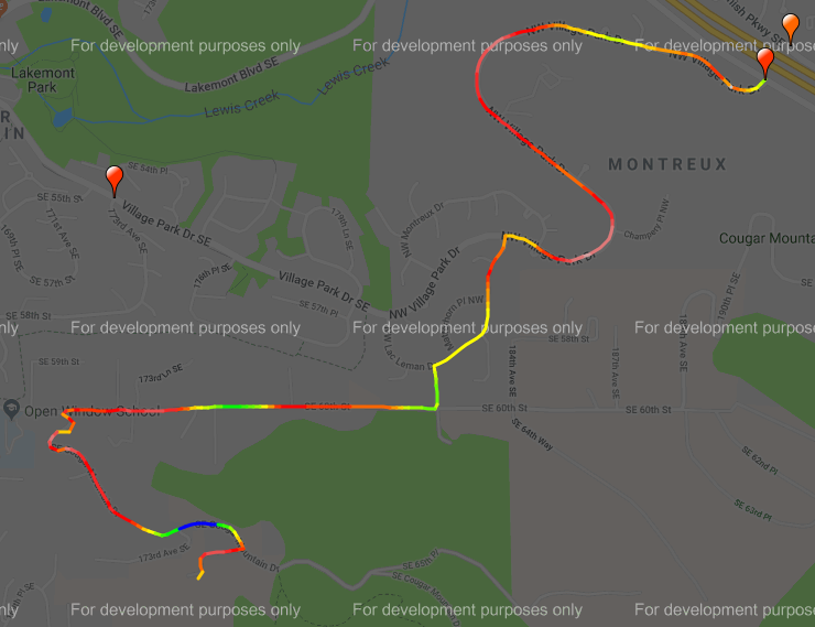
Here’s a picture of the route, click on it to see it in RideWithGPS.com. Clocks in at 1061’ of up.

image

This is not, in fact, the hardest route up this particular hill. We start on the bike path near I-90, climb into the highlands and then work our way into a neighborhood and then a special surprise at about the 4 mile mark. The upper part is the same as previous years, but is less confusing.

At the top of Grand Ridge there is a short bit of driveway that you can climb if you’d like an extra 30’ of elevation gain.

The descent through the development is nice, and then the descent down Highlands is a bit of a screamer and the pavement isn’t perfect, so I recommend paying some extra attention.

We end up back in Issaquah heading west on Sunset.

I will leave you in suspense, eagerly awaiting the next hill, assuming that you haven’t followed Sunset drive to the west and seen the exceedingly obvious climb #2.

Here’s the gradient view. Due to inaccuracies in the elevation data, it’s not very good; the start of the climb at the bottom is more in the 12%, and there is not a 20% kicker near the top.

image